Gilberto Camacho geodata
Gilberto Camacho (Puebla) is a populated place; located in Mexico in America/Mexico_City (GMT-6) time zone. With population of 1,633 people, there are 5302 cities with bigger population in this country. Compared to other cities in Mexico, 65% of cities are located further ↓South; 65% of cities are located further ←West and 74.1% of cities have higher elevation than Gilberto Camacho. Note1


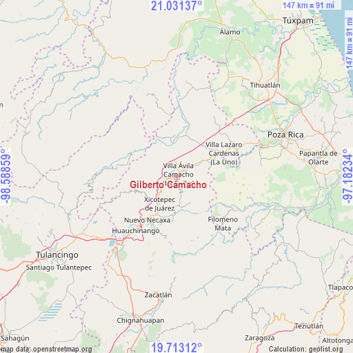
Gilberto Camacho GPS coordinates[2]
20° 22' 25.14" North, 97° 53' 7.656" West
| Map corner | latitude | longitude |
|---|---|---|
| Upper-left | 21.03137°, | -98.58859° |
| Center: | 20.37365°, | -97.88546° |
| Lower-right: | 19.71312°, | -97.18234° |
| Map W x H: | 146.6×146.6 km | = 91.1×91.1mi |
| max Lat: | 32.7° ⇑35% North |
| Gilberto Camacho: | 20.37365° |
| min Lat: | ⇓65% South 14.53588° |
| min Long | Gilberto Camach | max Long |
| -117.105° | -97.88546° | -86.73105° |
| W 65%⇐ | ⇒35% E |
Elevation
Elevation of Gilberto Camacho is 253 m = 830 ft, and this is 1000.7 m = 3283 ft below average elevation for this country.
| Max E: |
3497 m = 11473 ft | 74.1% |
| Avg. | 1253.7 m = 4113 ft | |
| Gilberto Camacho | 253 m = 830 ft | |
Min E: |
-1 m = -3 ft | 25.9% |
See also: Mexico elevation on elevation.city.
Geographical zone
Gilberto Camacho is located in North Torrid zone (between Equator and Tropic of Cancer). Distance of this Northern Tropic circle is 340.6 km =211.6 mi to North.| Distance of | km | miles | from Gilberto Camacho |
|---|---|---|---|
| North Pole | 7741.7 | 4810.5 | to North |
| Arctic Circle | 5135.8 | 3191.2 | to North |
| Tropic Cancer | 340.6 | 211.6 | to North |
| Equator | 2265.3 | 1407.6 | to South |


Nearby cities:
15 places around Gilberto Camacho: (largest is in red/bold)
• Agua Linda
8.2 km =5.1 mi,  13°
13°
• Apapantilla
5.2 km =3.2 mi,  50°
50°
• Ejido de Jalpan
9.9 km =6.2 mi,  344°
344°
• Itzatlán
11.2 km =7 mi,  247°
247°
• Jalapilla
3.2 km =2 mi,  259°
259°
• Nuevo Tenancingo
6.9 km =4.3 mi,  323°
323°
• Papaloctipan
9.2 km =5.7 mi,  307°
307°
• Plan de Ayala
7.3 km =4.5 mi,  331°
331°
• San Lorenzo
5.9 km =3.7 mi,  244°
244°
• San Pedro Petlacotla
5.2 km =3.2 mi, 324°
• Santa Rita
7.2 km =4.5 mi,  98°
98°
• Tenangulto
11.9 km =7.4 mi,  116°
116°
• Tlaxcalantongo
6.8 km =4.2 mi,  168°
168°
• Villa Avila Camacho
1.5 km =0.9 mi,  23°
23°
• Zacatal
10 km =6.2 mi,  267°
267°
Sources, notices
• [Note1] Compared only with cities in Mexico existing in our database
• [Src1] Map data: © OpenStreetMap contributors (CC-BY-SA)
• [Src2] Other city data from geonames.org with taken over terms of usage.
• [Src3] Geographical zone / Annual Mean Temperature by Robert A. Rohde @ Wikipedia
