Sacapuc geodata
Sacapuc (Yucatán) is a populated place; located in Mexico in America/Merida (GMT-6) time zone. With population of 690 people, there are 12606 cities with bigger population in this country. Compared to other cities in Mexico, 78.8% of cities are located further ↓South; 98.3% of cities are located further ←West and 96.3% of cities have higher elevation than Sacapuc. Note1


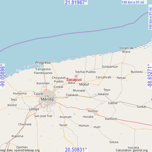
Sacapuc GPS coordinates[2]
21° 9' 55.584" North, 89° 21' 20.988" West
| Map corner | latitude | longitude |
|---|---|---|
| Upper-left | 21.81967°, | -90.05896° |
| Center: | 21.16544°, | -89.35583° |
| Lower-right: | 20.50831°, | -88.65271° |
| Map W x H: | 145.8×145.8 km | = 90.6×90.6mi |
| max Lat: | 32.7° ⇑21.2% North |
| Sacapuc: | 21.16544° |
| min Lat: | ⇓78.8% South 14.53588° |
| min Long | Sacapuc | max Long |
| -117.105° | -89.35583° | -86.73105° |
| W 98.3%⇐ | ⇒1.7% E |
Elevation
Elevation of Sacapuc is 11 m = 36 ft, and this is 1242.7 m = 4077 ft below average elevation for this country.
| Max E: |
3497 m = 11473 ft | 96.3% |
| Avg. | 1253.7 m = 4113 ft | |
| Sacapuc | 11 m = 36 ft | |
Min E: |
-1 m = -3 ft | 3.7% |
See also: Mexico elevation on elevation.city.
Geographical zone
Sacapuc is located in North Torrid zone (between Equator and Tropic of Cancer). Distance of this Northern Tropic circle is 252.5 km =156.9 mi to North.| Distance of | km | miles | from Sacapuc |
|---|---|---|---|
| North Pole | 7653.7 | 4755.8 | to North |
| Arctic Circle | 5047.8 | 3136.6 | to North |
| Tropic Cancer | 252.5 | 156.9 | to North |
| Equator | 2353.4 | 1462.3 | to South |


Nearby cities:
15 places around Sacapuc: (largest is in red/bold)
• Baca
7.7 km =4.8 mi,  215°
215°
• Dzemul
6.9 km =4.3 mi,  43°
43°
• Ixil
13.1 km =8.1 mi,  263°
263°
• Kancabal
11.8 km =7.3 mi,  121°
121°
• Kaxatah
13.2 km =8.2 mi,  126°
126°
• Kini
5.2 km =3.2 mi, 129°
• Mococha
12 km =7.5 mi,  236°
236°
• Motul
10.8 km =6.7 mi,  135°
135°
• Muxupip
14 km =8.7 mi,  168°
168°
• Tanya
12.7 km =7.9 mi, 118°
• Telchac Pueblo
9.9 km =6.2 mi,  64°
64°
• Timul
4.7 km =2.9 mi,  310°
310°
• Tixkunchell
10.5 km =6.5 mi,  204°
204°
• Uci
10 km =6.2 mi, 115°
• Yaxkukul
13.3 km =8.3 mi,  209°
209°
Sources, notices
• [Note1] Compared only with cities in Mexico existing in our database
• [Src1] Map data: © OpenStreetMap contributors (CC-BY-SA)
• [Src2] Other city data from geonames.org with taken over terms of usage.
• [Src3] Geographical zone / Annual Mean Temperature by Robert A. Rohde @ Wikipedia
