Yaxkukul geodata
Yaxkukul (Yucatán) is a seat of a second-order administrative division; located in Mexico in America/Merida (GMT-6) time zone. With population of 2,825 people, there are 3141 cities with bigger population in this country. Compared to other cities in Mexico, 77.4% of cities are located further ↓South; 98.2% of cities are located further ←West and 93.5% of cities have higher elevation than Yaxkukul. Note1


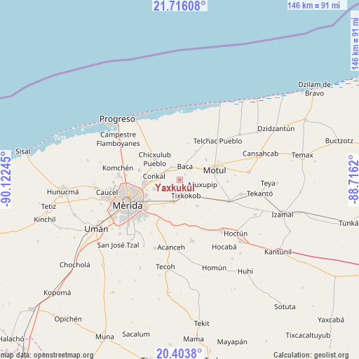
Yaxkukul GPS coordinates[2]
21° 3' 41.004" North, 89° 25' 9.552" West
| Map corner | latitude | longitude |
|---|---|---|
| Upper-left | 21.71608°, | -90.12245° |
| Center: | 21.06139°, | -89.41932° |
| Lower-right: | 20.4038°, | -88.7162° |
| Map W x H: | 145.9×145.9 km | = 90.7×90.7mi |
| max Lat: | 32.7° ⇑22.6% North |
| Yaxkukul: | 21.06139° |
| min Lat: | ⇓77.4% South 14.53588° |
| min Long | Yaxkukul | max Long |
| -117.105° | -89.41932° | -86.73105° |
| W 98.2%⇐ | ⇒1.8% E |
Elevation
Elevation of Yaxkukul is 16 m = 52 ft, and this is 1237.7 m = 4061 ft below average elevation for this country.
| Max E: |
3497 m = 11473 ft | 93.5% |
| Avg. | 1253.7 m = 4113 ft | |
| Yaxkukul | 16 m = 52 ft | |
Min E: |
-1 m = -3 ft | 6.5% |
See also: Mexico elevation on elevation.city.
Geographical zone
Yaxkukul is located in North Torrid zone (between Equator and Tropic of Cancer). Distance of this Northern Tropic circle is 264.1 km =164.1 mi to North.| Distance of | km | miles | from Yaxkukul |
|---|---|---|---|
| North Pole | 7665.3 | 4763 | to North |
| Arctic Circle | 5059.4 | 3143.8 | to North |
| Tropic Cancer | 264.1 | 164.1 | to North |
| Equator | 2341.8 | 1455.1 | to South |


Nearby cities:
15 places around Yaxkukul: (largest is in red/bold)
• Baca
5.7 km =3.5 mi,  22°
22°
• Chochoh
9 km =5.6 mi,  213°
213°
• Conkal
10.5 km =6.5 mi,  277°
277°
• Euan
10.7 km =6.6 mi,  132°
132°
• Ixil
12 km =7.5 mi,  327°
327°
• Mococha
6 km =3.7 mi, 325°
• Muxupip
9.6 km =6 mi,  102°
102°
• Nolo
5.8 km =3.6 mi,  183°
183°
• Oncan
12.8 km =8 mi, 211°
• San Antonio Millet
10.1 km =6.3 mi,  167°
167°
• Sitpach
11.3 km =7 mi,  249°
249°
• Tekát
6.8 km =4.2 mi,  305°
305°
• Tixkokob
7.1 km =4.4 mi,  158°
158°
• Tixkunchell
3 km =1.9 mi,  47°
47°
• Tixpehual
9.6 km =6 mi,  194°
194°
Sources, notices
• [Note1] Compared only with cities in Mexico existing in our database
• [Src1] Map data: © OpenStreetMap contributors (CC-BY-SA)
• [Src2] Other city data from geonames.org with taken over terms of usage.
• [Src3] Geographical zone / Annual Mean Temperature by Robert A. Rohde @ Wikipedia
