Mococha geodata
Mococha (Yucatán) is a seat of a second-order administrative division; located in Mexico in America/Merida (GMT-6) time zone. With population of 2,042 people, there are 4266 cities with bigger population in this country. Compared to other cities in Mexico, 78% of cities are located further ↓South; 98.2% of cities are located further ←West and 96.3% of cities have higher elevation than Mococha. Note1


Mococha GPS coordinates[2]
21° 6' 22.356" North, 89° 27' 7.812" West
| Map corner | latitude | longitude |
|---|---|---|
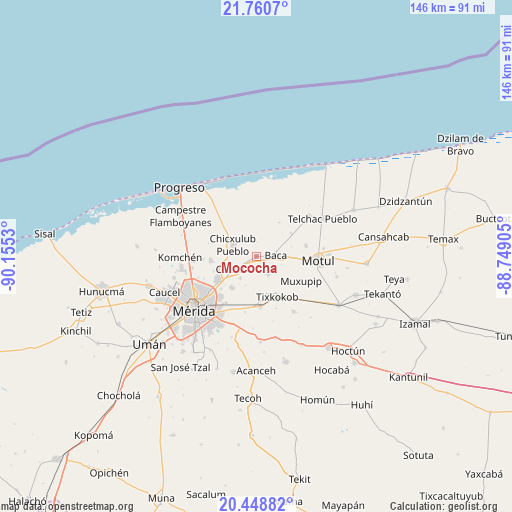
| Upper-left | 21.7607°, | -90.1553° |
| Center: | 21.10621°, | -89.45217° |
| Lower-right: | 20.44882°, | -88.74905° |
| Map W x H: | 145.9×145.9 km | = 90.7×90.7mi |
| max Lat: | 32.7° ⇑22% North |
| Mococha: | 21.10621° |
| min Lat: | ⇓78% South 14.53588° |
| min Long | Mococha | max Long |
| -117.105° | -89.45217° | -86.73105° |
| W 98.2%⇐ | ⇒1.8% E |
Elevation
Elevation of Mococha is 11 m = 36 ft, and this is 1242.7 m = 4077 ft below average elevation for this country.
| Max E: |
3497 m = 11473 ft | 96.3% |
| Avg. | 1253.7 m = 4113 ft | |
| Mococha | 11 m = 36 ft | |
Min E: |
-1 m = -3 ft | 3.7% |
See also: Mexico elevation on elevation.city.
Geographical zone
Mococha is located in North Torrid zone (between Equator and Tropic of Cancer). Distance of this Northern Tropic circle is 259.1 km =161 mi to North.| Distance of | km | miles | from Mococha |
|---|---|---|---|
| North Pole | 7660.3 | 4759.9 | to North |
| Arctic Circle | 5054.4 | 3140.7 | to North |
| Tropic Cancer | 259.1 | 161 | to North |
| Equator | 2346.8 | 1458.2 | to South |


Nearby cities:
15 places around Mococha: (largest is in red/bold)
• Baca
5.6 km =3.5 mi,  87°
87°
• Chablekal
13.1 km =8.1 mi,  265°
265°
• Chicxulub Pueblo
7.4 km =4.6 mi,  296°
296°
• Chochoh
12.6 km =7.8 mi,  187°
187°
• Cholul
13.1 km =8.1 mi,  237°
237°
• Conkal
7.9 km =4.9 mi, 242°
• Ixil
6 km =3.7 mi,  329°
329°
• Nolo
11.2 km =7 mi,  164°
164°
• Sacapuc
12 km =7.5 mi,  56°
56°
• Sitpach
11.4 km =7.1 mi,  218°
218°
• Tekát
2.4 km =1.5 mi, 244°
• Timul
11.6 km =7.2 mi,  33°
33°
• Tixkokob
13 km =8.1 mi,  152°
152°
• Tixkunchell
6.4 km =4 mi,  117°
117°
• Yaxkukul
6 km =3.7 mi, 145°
Sources, notices
• [Note1] Compared only with cities in Mexico existing in our database
• [Src1] Map data: © OpenStreetMap contributors (CC-BY-SA)
• [Src2] Other city data from geonames.org with taken over terms of usage.
• [Src3] Geographical zone / Annual Mean Temperature by Robert A. Rohde @ Wikipedia
