San Pablo Mitecatlán geodata
San Pablo Mitecatlán (Veracruz) is a populated place; located in Mexico in America/Mexico_City (GMT-6) time zone. With population of 913 people, there are 9556 cities with bigger population in this country. Compared to other cities in Mexico, 71.8% of cities are located further ↓South; 56.9% of cities are located further ←West and 50.1% of cities have lower elevation than San Pablo Mitecatlán. Note1


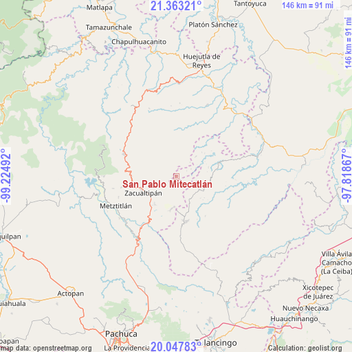
San Pablo Mitecatlán GPS coordinates[2]
20° 42' 25.02" North, 98° 31' 18.444" West
| Map corner | latitude | longitude |
|---|---|---|
| Upper-left | 21.36321°, | -99.22492° |
| Center: | 20.70695°, | -98.52179° |
| Lower-right: | 20.04783°, | -97.81867° |
| Map W x H: | 146.3×146.3 km | = 90.9×90.9mi |
| max Lat: | 32.7° ⇑28.2% North |
| San Pablo Mitecatlán: | 20.70695° |
| min Lat: | ⇓71.8% South 14.53588° |
| min Long | San Pablo Mitec | max Long |
| -117.105° | -98.52179° | -86.73105° |
| W 56.9%⇐ | ⇒43.1% E |
Elevation
Elevation of San Pablo Mitecatlán is 1438 m = 4718 ft, and this is 184.3 m = 605 ft above average elevation for this country.
| Max E: |
3497 m = 11473 ft | 49.9% |
| San Pablo Mitecatlán | 1438 m 4718 ft | |
| Avg. | 1253.7 m = 4113 ft | |
Min E: |
-1 m = -3 ft | 50.1% |
See also: Mexico elevation on elevation.city.
Geographical zone
San Pablo Mitecatlán is located in North Torrid zone (between Equator and Tropic of Cancer). Distance of this Northern Tropic circle is 303.5 km =188.6 mi to North.| Distance of | km | miles | from San Pablo Mitecatlán |
|---|---|---|---|
| North Pole | 7704.7 | 4787.5 | to North |
| Arctic Circle | 5098.8 | 3168.2 | to North |
| Tropic Cancer | 303.5 | 188.6 | to North |
| Equator | 2302.4 | 1430.6 | to South |


Nearby cities:
15 places around San Pablo Mitecatlán: (largest is in red/bold)
• Apachitla
4.9 km =3 mi,  63°
63°
• Coatlila
7.1 km =4.4 mi,  251°
251°
• Ilamatlán
11.6 km =7.2 mi,  44°
44°
• Ixcotitlán
5.6 km =3.5 mi,  350°
350°
• Jalapa
3.8 km =2.4 mi,  170°
170°
• Polintotla
6.6 km =4.1 mi,  13°
13°
• Soyatla
9.7 km =6 mi,  262°
262°
• Tecapa
6.8 km =4.2 mi, 64°
• Tianguistengo
11.7 km =7.3 mi,  281°
281°
• Tizapán
10 km =6.2 mi,  231°
231°
• Tlahuelompa (San Francisco Tlahuelompa)
8.4 km =5.2 mi,  221°
221°
• Xalacahuantla
9.3 km =5.8 mi,  18°
18°
• Xochimilco
8.9 km =5.5 mi, 6°
• Zilacatipan
11.1 km =6.9 mi,  120°
120°
• Zonzonapa
8.7 km =5.4 mi,  103°
103°
Sources, notices
• [Note1] Compared only with cities in Mexico existing in our database
• [Src1] Map data: © OpenStreetMap contributors (CC-BY-SA)
• [Src2] Other city data from geonames.org with taken over terms of usage.
• [Src3] Geographical zone / Annual Mean Temperature by Robert A. Rohde @ Wikipedia
