Ilamatlán geodata
Ilamatlán (Veracruz) is a seat of a second-order administrative division; located in Mexico in America/Mexico_City (GMT-6) time zone. With population of 717 people, there are 12151 cities with bigger population in this country. Compared to other cities in Mexico, 73% of cities are located further ↓South; 58% of cities are located further ←West and 55.9% of cities have higher elevation than Ilamatlán. Note1


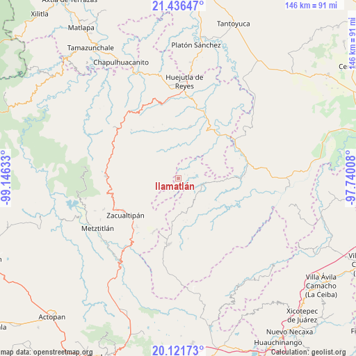
Ilamatlán GPS coordinates[2]
20° 46' 49.908" North, 98° 26' 35.52" West
| Map corner | latitude | longitude |
|---|---|---|
| Upper-left | 21.43647°, | -99.14633° |
| Center: | 20.78053°, | -98.4432° |
| Lower-right: | 20.12173°, | -97.74008° |
| Map W x H: | 146.2×146.2 km | = 90.8×90.8mi |
| max Lat: | 32.7° ⇑27% North |
| Ilamatlán: | 20.78053° |
| min Lat: | ⇓73% South 14.53588° |
| min Long | Ilamatlán | max Long |
| -117.105° | -98.4432° | -86.73105° |
| W 58%⇐ | ⇒42% E |
Elevation
Elevation of Ilamatlán is 1162 m = 3812 ft, and this is 91.7 m = 301 ft below average elevation for this country.
| Max E: |
3497 m = 11473 ft | 55.9% |
| Avg. | 1253.7 m = 4113 ft | |
| Ilamatlán | 1162 m = 3812 ft | |
Min E: |
-1 m = -3 ft | 44.1% |
See also: Mexico elevation on elevation.city.
Geographical zone
Ilamatlán is located in North Torrid zone (between Equator and Tropic of Cancer). Distance of this Northern Tropic circle is 295.3 km =183.5 mi to North.| Distance of | km | miles | from Ilamatlán |
|---|---|---|---|
| North Pole | 7696.5 | 4782.4 | to North |
| Arctic Circle | 5090.6 | 3163.2 | to North |
| Tropic Cancer | 295.3 | 183.5 | to North |
| Equator | 2310.6 | 1435.7 | to South |


Nearby cities:
15 places around Ilamatlán: (largest is in red/bold)
• Aguacatitla
9.1 km =5.7 mi,  9°
9°
• Apachitla
7.1 km =4.4 mi,  212°
212°
• Arnatepec
3.9 km =2.4 mi,  69°
69°
• Atempa
4 km =2.5 mi,  134°
134°
• Chahuatlán
5.2 km =3.2 mi,  86°
86°
• Coacoaco
5.3 km =3.3 mi, 7°
• Ixcotitlán
9.5 km =5.9 mi,  253°
253°
• José María Pino Suárez
6.8 km =4.2 mi, 131°
• Polintotla
6.9 km =4.3 mi,  255°
255°
• San Gregorio
7 km =4.3 mi,  51°
51°
• Santa Cruz
3 km =1.9 mi, 54°
• Tecapa
5.6 km =3.5 mi,  201°
201°
• Xalacahuantla
5.2 km =3.2 mi,  277°
277°
• Xochimilco
7.2 km =4.5 mi, 275°
• Zacatipán
9.5 km =5.9 mi,  312°
312°
Sources, notices
• [Note1] Compared only with cities in Mexico existing in our database
• [Src1] Map data: © OpenStreetMap contributors (CC-BY-SA)
• [Src2] Other city data from geonames.org with taken over terms of usage.
• [Src3] Geographical zone / Annual Mean Temperature by Robert A. Rohde @ Wikipedia
