Xochimilco geodata
Xochimilco (Hidalgo) is a populated place; located in Mexico in America/Mexico_City (GMT-6) time zone. With population of 777 people, there are 11245 cities with bigger population in this country. Compared to other cities in Mexico, 73.1% of cities are located further ↓South; 57.1% of cities are located further ←West and 55.3% of cities have higher elevation than Xochimilco. Note1


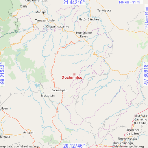
Xochimilco GPS coordinates[2]
20° 47' 10.464" North, 98° 30' 44.28" West
| Map corner | latitude | longitude |
|---|---|---|
| Upper-left | 21.44216°, | -99.21543° |
| Center: | 20.78624°, | -98.5123° |
| Lower-right: | 20.12746°, | -97.80918° |
| Map W x H: | 146.2×146.2 km | = 90.8×90.8mi |
| max Lat: | 32.7° ⇑26.9% North |
| Xochimilco: | 20.78624° |
| min Lat: | ⇓73.1% South 14.53588° |
| min Long | Xochimilco | max Long |
| -117.105° | -98.5123° | -86.73105° |
| W 57.1%⇐ | ⇒42.9% E |
Elevation
Elevation of Xochimilco is 1185 m = 3888 ft, and this is 68.7 m = 225 ft below average elevation for this country.
| Max E: |
3497 m = 11473 ft | 55.3% |
| Avg. | 1253.7 m = 4113 ft | |
| Xochimilco | 1185 m = 3888 ft | |
Min E: |
-1 m = -3 ft | 44.7% |
See also: Mexico elevation on elevation.city.
Geographical zone
Xochimilco is located in North Torrid zone (between Equator and Tropic of Cancer). Distance of this Northern Tropic circle is 294.7 km =183.1 mi to North.| Distance of | km | miles | from Xochimilco |
|---|---|---|---|
| North Pole | 7695.8 | 4781.9 | to North |
| Arctic Circle | 5090 | 3162.8 | to North |
| Tropic Cancer | 294.7 | 183.1 | to North |
| Equator | 2311.2 | 1436.1 | to South |


Nearby cities:
15 places around Xochimilco: (largest is in red/bold)
• Apachitla
7.5 km =4.7 mi,  152°
152°
• Arnatepec
10.9 km =6.8 mi,  86°
86°
• Atempa
10.6 km =6.6 mi,  109°
109°
• Atempa
11 km =6.8 mi,  12°
12°
• Coacoaco
9.1 km =5.7 mi,  59°
59°
• Ilamatlán
7.2 km =4.5 mi,  95°
95°
• Ixcotitlán
3.8 km =2.4 mi,  209°
209°
• Polintotla
2.4 km =1.5 mi,  168°
168°
• San Miguel
5.3 km =3.3 mi,  317°
317°
• San Pablo Mitecatlán
8.9 km =5.5 mi,  186°
186°
• Santa Cruz
9.7 km =6 mi,  83°
83°
• Tecapa
7.8 km =4.8 mi,  138°
138°
• Tuzancoac
8.8 km =5.5 mi,  330°
330°
• Xalacahuantla
2 km =1.2 mi, 89°
• Zacatipán
5.7 km =3.5 mi,  1°
1°
Sources, notices
• [Note1] Compared only with cities in Mexico existing in our database
• [Src1] Map data: © OpenStreetMap contributors (CC-BY-SA)
• [Src2] Other city data from geonames.org with taken over terms of usage.
• [Src3] Geographical zone / Annual Mean Temperature by Robert A. Rohde @ Wikipedia
