Apachitla geodata
Apachitla (Veracruz) is a populated place; located in Mexico in America/Mexico_City (GMT-6) time zone. With population of 581 people, there are 14753 cities with bigger population in this country. Compared to other cities in Mexico, 72.1% of cities are located further ↓South; 57.5% of cities are located further ←West and 52% of cities have higher elevation than Apachitla. Note1


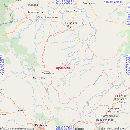
Apachitla GPS coordinates[2]
20° 43' 36.012" North, 98° 28' 45.984" West
| Map corner | latitude | longitude |
|---|---|---|
| Upper-left | 21.38285°, | -99.18257° |
| Center: | 20.72667°, | -98.47944° |
| Lower-right: | 20.06764°, | -97.77632° |
| Map W x H: | 146.2×146.2 km | = 90.8×90.8mi |
| max Lat: | 32.7° ⇑27.9% North |
| Apachitla: | 20.72667° |
| min Lat: | ⇓72.1% South 14.53588° |
| min Long | Apachitla | max Long |
| -117.105° | -98.47944° | -86.73105° |
| W 57.5%⇐ | ⇒42.5% E |
Elevation
Elevation of Apachitla is 1336 m = 4383 ft, and this is 82.3 m = 270 ft above average elevation for this country.
| Max E: |
3497 m = 11473 ft | 52% |
| Apachitla | 1336 m 4383 ft | |
| Avg. | 1253.7 m = 4113 ft | |
Min E: |
-1 m = -3 ft | 48% |
See also: Mexico elevation on elevation.city.
Geographical zone
Apachitla is located in North Torrid zone (between Equator and Tropic of Cancer). Distance of this Northern Tropic circle is 301.3 km =187.2 mi to North.| Distance of | km | miles | from Apachitla |
|---|---|---|---|
| North Pole | 7702.5 | 4786.1 | to North |
| Arctic Circle | 5096.6 | 3166.9 | to North |
| Tropic Cancer | 301.3 | 187.2 | to North |
| Equator | 2304.6 | 1432 | to South |


Nearby cities:
15 places around Apachitla: (largest is in red/bold)
• Arnatepec
10.4 km =6.5 mi,  45°
45°
• Atempa
7.3 km =4.5 mi,  64°
64°
• Chahuatlán
10.9 km =6.8 mi, 54°
• Ilamatlán
7.1 km =4.4 mi,  32°
32°
• Ixcotitlán
6.3 km =3.9 mi,  301°
301°
• Jalapa
7.1 km =4.4 mi,  212°
212°
• José María Pino Suárez
9 km =5.6 mi,  80°
80°
• Polintotla
5.1 km =3.2 mi,  325°
325°
• San Pablo Mitecatlán
4.9 km =3 mi,  243°
243°
• Santa Cruz
9.9 km =6.2 mi,  38°
38°
• Tecapa
1.9 km =1.2 mi,  66°
66°
• Xalacahuantla
6.8 km =4.2 mi,  348°
348°
• Xochimilco
7.5 km =4.7 mi, 332°
• Zilacatipan
9.3 km =5.8 mi,  146°
146°
• Zonzonapa
5.8 km =3.6 mi,  135°
135°
Sources, notices
• [Note1] Compared only with cities in Mexico existing in our database
• [Src1] Map data: © OpenStreetMap contributors (CC-BY-SA)
• [Src2] Other city data from geonames.org with taken over terms of usage.
• [Src3] Geographical zone / Annual Mean Temperature by Robert A. Rohde @ Wikipedia
