Jalapa geodata
Jalapa (Hidalgo) is a populated place; located in Mexico in America/Mexico_City (GMT-6) time zone. With population of 501 people, there are 16785 cities with bigger population in this country. Compared to other cities in Mexico, 71.3% of cities are located further ↓South; 57% of cities are located further ←West and 51.6% of cities have lower elevation than Jalapa. Note1


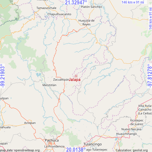
Jalapa GPS coordinates[2]
20° 40' 23.016" North, 98° 30' 57.24" West
| Map corner | latitude | longitude |
|---|---|---|
| Upper-left | 21.32947°, | -99.21903° |
| Center: | 20.67306°, | -98.5159° |
| Lower-right: | 20.0138°, | -97.81278° |
| Map W x H: | 146.3×146.3 km | = 90.9×90.9mi |
| max Lat: | 32.7° ⇑28.7% North |
| Jalapa: | 20.67306° |
| min Lat: | ⇓71.3% South 14.53588° |
| min Long | Jalapa | max Long |
| -117.105° | -98.5159° | -86.73105° |
| W 57%⇐ | ⇒43% E |
Elevation
Elevation of Jalapa is 1509 m = 4951 ft, and this is 255.3 m = 838 ft above average elevation for this country.
| Max E: |
3497 m = 11473 ft | 48.4% |
| Jalapa | 1509 m 4951 ft | |
| Avg. | 1253.7 m = 4113 ft | |
Min E: |
-1 m = -3 ft | 51.6% |
See also: Mexico elevation on elevation.city.
Geographical zone
Jalapa is located in North Torrid zone (between Equator and Tropic of Cancer). Distance of this Northern Tropic circle is 307.3 km =190.9 mi to North.| Distance of | km | miles | from Jalapa |
|---|---|---|---|
| North Pole | 7708.4 | 4789.8 | to North |
| Arctic Circle | 5102.5 | 3170.5 | to North |
| Tropic Cancer | 307.3 | 190.9 | to North |
| Equator | 2298.6 | 1428.3 | to South |


Nearby cities:
15 places around Jalapa: (largest is in red/bold)
• Apachitla
7.1 km =4.4 mi,  32°
32°
• Atopixco
12.4 km =7.7 mi,  229°
229°
• Carpinteros
10 km =6.2 mi,  194°
194°
• Coatlila
7.5 km =4.7 mi,  281°
281°
• Ixcotitlán
9.4 km =5.8 mi,  350°
350°
• La Mojonera
12.1 km =7.5 mi,  244°
244°
• La Selva
11.8 km =7.3 mi,  174°
174°
• Polintotla
10.2 km =6.3 mi,  4°
4°
• San Pablo Mitecatlán
3.8 km =2.4 mi, 350°
• Soyatla
10.5 km =6.5 mi, 283°
• Tecapa
8.7 km =5.4 mi,  39°
39°
• Tizapán
8.8 km =5.5 mi,  254°
254°
• Tlahuelompa (San Francisco Tlahuelompa)
6.6 km =4.1 mi, 248°
• Zilacatipan
9.1 km =5.7 mi,  101°
101°
• Zonzonapa
8.1 km =5 mi,  77°
77°
Sources, notices
• [Note1] Compared only with cities in Mexico existing in our database
• [Src1] Map data: © OpenStreetMap contributors (CC-BY-SA)
• [Src2] Other city data from geonames.org with taken over terms of usage.
• [Src3] Geographical zone / Annual Mean Temperature by Robert A. Rohde @ Wikipedia
