Puerto General Nicolás Bravo (Filo de Caballos) geodata
Puerto General Nicolás Bravo (Filo de Caballos) (Guerrero) is a populated place; located in Mexico in America/Mexico_City (GMT-6) time zone. With population of 897 people, there are 9721 cities with bigger population in this country. Compared to other cities in Mexico, 81.8% of cities are located further ↑North; 62.1% of cities are located further →East and 91% of cities have lower elevation than Puerto General Nicolás Bravo (Filo de Caballos). Note1
Current local time in Puerto General Nicolás Bravo (Filo de Caballos):
06:51 AM, WednesdayDifference from your time zone: hours


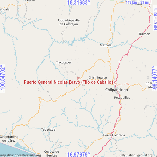
Puerto General Nicolás Bravo (Filo de Caballos) GPS coordinates[2]
17° 38' 53.016" North, 99° 50' 38.004" West
| Map corner | latitude | longitude |
|---|---|---|
| Upper-left | 18.31683°, | -100.54702° |
| Center: | 17.64806°, | -99.84389° |
| Lower-right: | 16.97679°, | -99.14077° |
| Map W x H: | 149×149 km | = 92.6×92.6mi |
| max Lat: | 32.7° ⇑81.8% North |
| Puerto General Nicolás Bravo (Filo de Caballos): | 17.64806° |
| min Lat: | ⇓18.2% South 14.53588° |
| min Long | Puerto General | max Long |
| -117.105° | -99.84389° | -86.73105° |
| W 37.9%⇐ | ⇒62.1% E |
Elevation
Elevation of Puerto General Nicolás Bravo (Filo de Caballos) is 2439 m = 8002 ft, and this is 1185.3 m = 3889 ft above average elevation for this country.
| Max E: |
3497 m = 11473 ft | 9% |
| Puerto General Nicolás Bravo (Filo de Caballos) | 2439 m 8002 ft | |
| Avg. | 1253.7 m = 4113 ft | |
Min E: |
-1 m = -3 ft | 91% |
See also: Mexico elevation on elevation.city.
Geographical zone
Puerto General Nicolás Bravo (Filo de Caballos) is located in North Torrid zone (between Equator and Tropic of Cancer). Distance of this Northern Tropic circle is 643.6 km =399.9 mi to North.| Distance of | km | miles | from Puerto General Nicolás Bravo (Filo de Caballos) |
|---|---|---|---|
| North Pole | 8044.8 | 4998.8 | to North |
| Arctic Circle | 5438.9 | 3379.6 | to North |
| Tropic Cancer | 643.6 | 399.9 | to North |
| Equator | 1962.3 | 1219.3 | to South |


Nearby cities:
15 places around Puerto General Nicolás Bravo (Filo de Caballos): (largest is in red/bold)
• Campo de Aviación
2.8 km =1.7 mi,  67°
67°
• Carrizal de Bravo
3.2 km =2 mi,  167°
167°
• Chichihualco
17.8 km =11.1 mi,  86°
86°
• Colonia General Heliodoro Castillo (Chicahuales)
17 km =10.6 mi,  207°
207°
• Corral de Piedra
10.7 km =6.6 mi,  277°
277°
• El Balzamar
9 km =5.6 mi,  155°
155°
• El Naranjo
12 km =7.5 mi,  59°
59°
• Huerta Vieja
11.2 km =7 mi,  288°
288°
• Iyotla
10.6 km =6.6 mi,  105°
105°
• Izotepec
13.7 km =8.5 mi,  239°
239°
• Puerto del Varal
12.9 km =8 mi,  301°
301°
• Tepozonalco
12 km =7.5 mi, 114°
• Tlacotenco
17.4 km =10.8 mi,  328°
328°
• Yextla
10.8 km =6.7 mi, 243°
• Zopilostoc
18.7 km =11.6 mi, 303°
Sources, notices
• [Note1] Compared only with cities in Mexico existing in our database
• [Src1] Map data: © OpenStreetMap contributors (CC-BY-SA)
• [Src2] Other city data from geonames.org with taken over terms of usage.
• [Src3] Geographical zone / Annual Mean Temperature by Robert A. Rohde @ Wikipedia
