Coatepec Costales geodata
Coatepec Costales (Guerrero) is a populated place; located in Mexico in America/Mexico_City (GMT-6) time zone. With population of 1,130 people, there are 7675 cities with bigger population in this country. Compared to other cities in Mexico, 74.4% of cities are located further ↑North; 60.5% of cities are located further →East and 53% of cities have higher elevation than Coatepec Costales. Note1


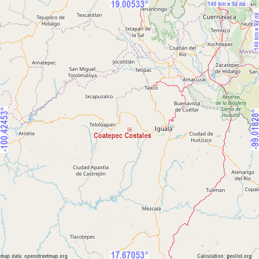
Coatepec Costales GPS coordinates[2]
18° 20' 21.192" North, 99° 43' 17.04" West
| Map corner | latitude | longitude |
|---|---|---|
| Upper-left | 19.00533°, | -100.42453° |
| Center: | 18.33922°, | -99.7214° |
| Lower-right: | 17.67053°, | -99.01828° |
| Map W x H: | 148.4×148.4 km | = 92.2×92.2mi |
| max Lat: | 32.7° ⇑74.4% North |
| Coatepec Costales: | 18.33922° |
| min Lat: | ⇓25.6% South 14.53588° |
| min Long | Coatepec Costal | max Long |
| -117.105° | -99.7214° | -86.73105° |
| W 39.5%⇐ | ⇒60.5% E |
Elevation
Elevation of Coatepec Costales is 1291 m = 4236 ft, and this is 37.3 m = 122 ft above average elevation for this country.
| Max E: |
3497 m = 11473 ft | 53% |
| Coatepec Costales | 1291 m 4236 ft | |
| Avg. | 1253.7 m = 4113 ft | |
Min E: |
-1 m = -3 ft | 47% |
See also: Mexico elevation on elevation.city.
Geographical zone
Coatepec Costales is located in North Torrid zone (between Equator and Tropic of Cancer). Distance of this Northern Tropic circle is 566.8 km =352.2 mi to North.| Distance of | km | miles | from Coatepec Costales |
|---|---|---|---|
| North Pole | 7967.9 | 4951 | to North |
| Arctic Circle | 5362 | 3331.8 | to North |
| Tropic Cancer | 566.8 | 352.2 | to North |
| Equator | 2039.1 | 1267 | to South |


Nearby cities:
15 places around Coatepec Costales: (largest is in red/bold)
• Ahuehuepan
7.5 km =4.7 mi,  88°
88°
• Apango
12.4 km =7.7 mi,  158°
158°
• Atlixtac
16.1 km =10 mi, 162°
• Chilacachapa
8.4 km =5.2 mi,  210°
210°
• Cocula
12.6 km =7.8 mi,  150°
150°
• Colonia el Pedregal
14.3 km =8.9 mi,  274°
274°
• El Calvario
11.3 km =7 mi,  241°
241°
• Huixtac
15.1 km =9.4 mi,  25°
25°
• Los Sauces
14.5 km =9 mi, 236°
• Metlapa
12.3 km =7.6 mi,  105°
105°
• San Martín Pachivia (Pachivia)
10.4 km =6.5 mi,  317°
317°
• Temaxcalapa
10.8 km =6.7 mi, 28°
• Tianquizolco
13.4 km =8.3 mi,  195°
195°
• Tlacuitlapa
1.9 km =1.2 mi,  128°
128°
• Tonalapa del Río
3.2 km =2 mi,  84°
84°
Sources, notices
• [Note1] Compared only with cities in Mexico existing in our database
• [Src1] Map data: © OpenStreetMap contributors (CC-BY-SA)
• [Src2] Other city data from geonames.org with taken over terms of usage.
• [Src3] Geographical zone / Annual Mean Temperature by Robert A. Rohde @ Wikipedia
