Acuautla geodata
Acuautla (Hidalgo) is a populated place; located in Mexico in America/Mexico_City (GMT-6) time zone. With population of 759 people, there are 11537 cities with bigger population in this country. Compared to other cities in Mexico, 67.6% of cities are located further ↓South; 63.2% of cities are located further ←West and 64.8% of cities have higher elevation than Acuautla. Note1


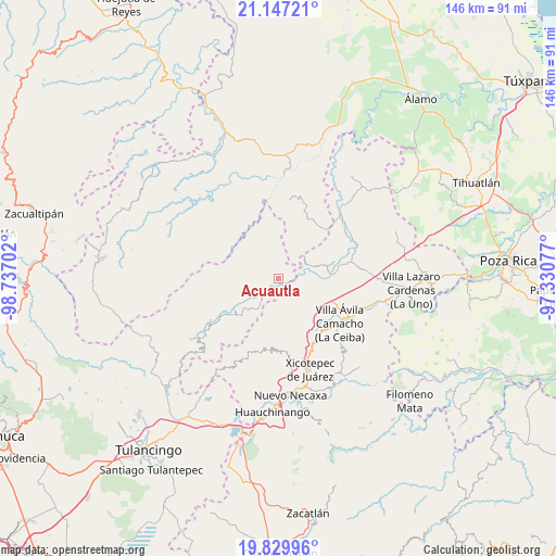
Acuautla GPS coordinates[2]
20° 29' 24" North, 98° 2' 2.004" West
| Map corner | latitude | longitude |
|---|---|---|
| Upper-left | 21.14721°, | -98.73702° |
| Center: | 20.49°, | -98.03389° |
| Lower-right: | 19.82996°, | -97.33077° |
| Map W x H: | 146.5×146.5 km | = 91×91mi |
| max Lat: | 32.7° ⇑32.4% North |
| Acuautla: | 20.49° |
| min Lat: | ⇓67.6% South 14.53588° |
| min Long | Acuautla | max Long |
| -117.105° | -98.03389° | -86.73105° |
| W 63.2%⇐ | ⇒36.8% E |
Elevation
Elevation of Acuautla is 696 m = 2283 ft, and this is 557.7 m = 1830 ft below average elevation for this country.
| Max E: |
3497 m = 11473 ft | 64.8% |
| Avg. | 1253.7 m = 4113 ft | |
| Acuautla | 696 m = 2283 ft | |
Min E: |
-1 m = -3 ft | 35.2% |
See also: Mexico elevation on elevation.city.
Geographical zone
Acuautla is located in North Torrid zone (between Equator and Tropic of Cancer). Distance of this Northern Tropic circle is 327.6 km =203.6 mi to North.| Distance of | km | miles | from Acuautla |
|---|---|---|---|
| North Pole | 7728.8 | 4802.5 | to North |
| Arctic Circle | 5122.9 | 3183.2 | to North |
| Tropic Cancer | 327.6 | 203.6 | to North |
| Equator | 2278.3 | 1415.7 | to South |


Nearby cities:
15 places around Acuautla: (largest is in red/bold)
• Acalmán
8.1 km =5 mi,  199°
199°
• Barrio Aztlán
6 km =3.7 mi,  243°
243°
• El Pozo
6.9 km =4.3 mi,  66°
66°
• El Rincón
6.7 km =4.2 mi,  154°
154°
• Huehuetla
5.5 km =3.4 mi,  233°
233°
• Ixtololoya
8.1 km =5 mi,  62°
62°
• Juntas Chicas
9.3 km =5.8 mi,  2°
2°
• San Ambrosio
4.5 km =2.8 mi,  17°
17°
• San Andrés
6.6 km =4.1 mi,  281°
281°
• San Antonio el Grande
3.7 km =2.3 mi,  181°
181°
• San Esteban
6.6 km =4.1 mi,  335°
335°
• San Francisco
7.7 km =4.8 mi,  25°
25°
• San Gregorio
1.9 km =1.2 mi, 61°
• Santa Inés
7 km =4.3 mi, 237°
• Tlaxco
7.4 km =4.6 mi, 176°
Sources, notices
• [Note1] Compared only with cities in Mexico existing in our database
• [Src1] Map data: © OpenStreetMap contributors (CC-BY-SA)
• [Src2] Other city data from geonames.org with taken over terms of usage.
• [Src3] Geographical zone / Annual Mean Temperature by Robert A. Rohde @ Wikipedia
