Ignacio Mejía geodata
Ignacio Mejía (Oaxaca) is a populated place; located in Mexico in America/Mexico_City (GMT-6) time zone. With population of 612 people, there are 14088 cities with bigger population in this country. Compared to other cities in Mexico, 77.6% of cities are located further ↑North; 73.4% of cities are located further ←West and 64% of cities have higher elevation than Ignacio Mejía. Note1


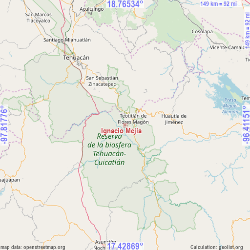
Ignacio Mejía GPS coordinates[2]
18° 5' 53.844" North, 97° 6' 52.668" West
| Map corner | latitude | longitude |
|---|---|---|
| Upper-left | 18.76534°, | -97.81776° |
| Center: | 18.09829°, | -97.11463° |
| Lower-right: | 17.42869°, | -96.41151° |
| Map W x H: | 148.6×148.6 km | = 92.3×92.3mi |
| max Lat: | 32.7° ⇑77.6% North |
| Ignacio Mejía: | 18.09829° |
| min Lat: | ⇓22.4% South 14.53588° |
| min Long | Ignacio Mejía | max Long |
| -117.105° | -97.11463° | -86.73105° |
| W 73.4%⇐ | ⇒26.6% E |
Elevation
Elevation of Ignacio Mejía is 750 m = 2461 ft, and this is 503.7 m = 1653 ft below average elevation for this country.
| Max E: |
3497 m = 11473 ft | 64% |
| Avg. | 1253.7 m = 4113 ft | |
| Ignacio Mejía | 750 m = 2461 ft | |
Min E: |
-1 m = -3 ft | 36% |
See also: Mexico elevation on elevation.city.
Geographical zone
Ignacio Mejía is located in North Torrid zone (between Equator and Tropic of Cancer). Distance of this Northern Tropic circle is 593.6 km =368.8 mi to North.| Distance of | km | miles | from Ignacio Mejía |
|---|---|---|---|
| North Pole | 7994.7 | 4967.7 | to North |
| Arctic Circle | 5388.8 | 3348.4 | to North |
| Tropic Cancer | 593.6 | 368.8 | to North |
| Equator | 2012.3 | 1250.4 | to South |


Nearby cities:
15 places around Ignacio Mejía: (largest is in red/bold)
• Axuxco
17.7 km =11 mi,  326°
326°
• Chichiltepec
15.9 km =9.9 mi,  9°
9°
• Coxcatlán
19.2 km =11.9 mi,  348°
348°
• El Duraznillo
13.9 km =8.6 mi,  83°
83°
• Los Frailes
17.5 km =10.9 mi,  88°
88°
• Nanahuatípam
4.1 km =2.5 mi,  344°
344°
• San José Tilapa
7.4 km =4.6 mi, 10°
• San Juan de los Cues
8.1 km =5 mi,  135°
135°
• Santa María Teopoxco
18.5 km =11.5 mi,  65°
65°
• Tecomavaca
18.6 km =11.6 mi,  148°
148°
• Tecuanapam
17.8 km =11.1 mi, 66°
• Teotitlán
6 km =3.7 mi,  51°
51°
• Tepantitlán
18.3 km =11.4 mi, 48°
• Toxpalan
5.9 km =3.7 mi, 86°
• Villa Nueva
16.7 km =10.4 mi,  57°
57°
Sources, notices
• [Note1] Compared only with cities in Mexico existing in our database
• [Src1] Map data: © OpenStreetMap contributors (CC-BY-SA)
• [Src2] Other city data from geonames.org with taken over terms of usage.
• [Src3] Geographical zone / Annual Mean Temperature by Robert A. Rohde @ Wikipedia
