Chahuatitla geodata
Chahuatitla (Hidalgo) is a populated place; located in Mexico in America/Mexico_City (GMT-6) time zone. With population of 607 people, there are 14186 cities with bigger population in this country. Compared to other cities in Mexico, 78.2% of cities are located further ↓South; 52.9% of cities are located further ←West and 68.2% of cities have higher elevation than Chahuatitla. Note1


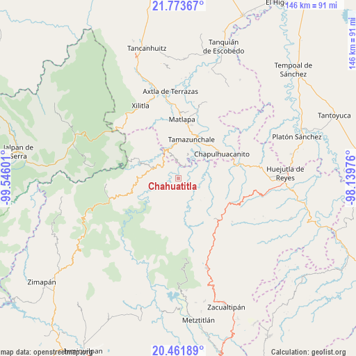
Chahuatitla GPS coordinates[2]
21° 7' 9.228" North, 98° 50' 34.368" West
| Map corner | latitude | longitude |
|---|---|---|
| Upper-left | 21.77367°, | -99.54601° |
| Center: | 21.11923°, | -98.84288° |
| Lower-right: | 20.46189°, | -98.13976° |
| Map W x H: | 145.9×145.9 km | = 90.7×90.7mi |
| max Lat: | 32.7° ⇑21.8% North |
| Chahuatitla: | 21.11923° |
| min Lat: | ⇓78.2% South 14.53588° |
| min Long | Chahuatitla | max Long |
| -117.105° | -98.84288° | -86.73105° |
| W 52.9%⇐ | ⇒47.1% E |
Elevation
Elevation of Chahuatitla is 513 m = 1683 ft, and this is 740.7 m = 2430 ft below average elevation for this country.
| Max E: |
3497 m = 11473 ft | 68.2% |
| Avg. | 1253.7 m = 4113 ft | |
| Chahuatitla | 513 m = 1683 ft | |
Min E: |
-1 m = -3 ft | 31.8% |
See also: Mexico elevation on elevation.city.
Geographical zone
Chahuatitla is located in North Torrid zone (between Equator and Tropic of Cancer). Distance of this Northern Tropic circle is 257.7 km =160.1 mi to North.| Distance of | km | miles | from Chahuatitla |
|---|---|---|---|
| North Pole | 7658.8 | 4759 | to North |
| Arctic Circle | 5052.9 | 3139.7 | to North |
| Tropic Cancer | 257.7 | 160.1 | to North |
| Equator | 2348.2 | 1459.1 | to South |


Nearby cities:
15 places around Chahuatitla: (largest is in red/bold)
• Acoyotla
6.8 km =4.2 mi,  84°
84°
• Amola de Ocampo
7.6 km =4.7 mi,  226°
226°
• Cahuazas
2.7 km =1.7 mi,  332°
332°
• Cahuazaz de Morelos (Rancho Alegre)
3.8 km =2.4 mi,  6°
6°
• Chapulhuacán
7.6 km =4.7 mi,  303°
303°
• Cuatolol
1.8 km =1.1 mi,  88°
88°
• El Carrizal
7.6 km =4.7 mi, 5°
• La Reforma
5.9 km =3.7 mi,  209°
209°
• Texcapa
3.2 km =2 mi,  201°
201°
• Teyahuala
7.7 km =4.8 mi,  181°
181°
• Tezapotla
6.8 km =4.2 mi,  27°
27°
• Tlachiquilillacapa
6 km =3.7 mi,  2°
2°
• Tlalnepantla
6.8 km =4.2 mi,  357°
357°
• Xilitla
6.6 km =4.1 mi,  145°
145°
• Zacualtipanito
5.9 km =3.7 mi,  48°
48°
Sources, notices
• [Note1] Compared only with cities in Mexico existing in our database
• [Src1] Map data: © OpenStreetMap contributors (CC-BY-SA)
• [Src2] Other city data from geonames.org with taken over terms of usage.
• [Src3] Geographical zone / Annual Mean Temperature by Robert A. Rohde @ Wikipedia
