Agua de Pajarito geodata
Agua de Pajarito (Chiapas) is a populated place; located in Mexico in America/Mexico_City (GMT-6) time zone. With population of 503 people, there are 16722 cities with bigger population in this country. Compared to other cities in Mexico, 92.4% of cities are located further ↑North; 91.3% of cities are located further ←West and 91.6% of cities have lower elevation than Agua de Pajarito. Note1


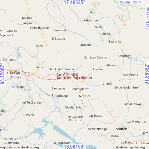
Agua de Pajarito GPS coordinates[2]
16° 44' 9.996" North, 92° 34' 0.984" West
| Map corner | latitude | longitude |
|---|---|---|
| Upper-left | 17.40825°, | -93.27007° |
| Center: | 16.73611°, | -92.56694° |
| Lower-right: | 16.06159°, | -91.86382° |
| Map W x H: | 149.7×149.7 km | = 93×93mi |
| max Lat: | 32.7° ⇑92.4% North |
| Agua de Pajarito: | 16.73611° |
| min Lat: | ⇓7.6% South 14.53588° |
| min Long | Agua de Pajarit | max Long |
| -117.105° | -92.56694° | -86.73105° |
| W 91.3%⇐ | ⇒8.7% E |
Elevation
Elevation of Agua de Pajarito is 2462 m = 8077 ft, and this is 1208.3 m = 3964 ft above average elevation for this country.
| Max E: |
3497 m = 11473 ft | 8.4% |
| Agua de Pajarito | 2462 m 8077 ft | |
| Avg. | 1253.7 m = 4113 ft | |
Min E: |
-1 m = -3 ft | 91.6% |
See also: Mexico elevation on elevation.city.
Geographical zone
Agua de Pajarito is located in North Torrid zone (between Equator and Tropic of Cancer). Distance of this Northern Tropic circle is 745 km =462.9 mi to North.| Distance of | km | miles | from Agua de Pajarito |
|---|---|---|---|
| North Pole | 8146.2 | 5061.8 | to North |
| Arctic Circle | 5540.3 | 3442.6 | to North |
| Tropic Cancer | 745 | 462.9 | to North |
| Equator | 1860.9 | 1156.3 | to South |


Nearby cities:
15 places around Agua de Pajarito: (largest is in red/bold)
• Chilimjoveltic
5.9 km =3.7 mi,  346°
346°
• Corazón de María
5.3 km =3.3 mi,  139°
139°
• Cruztón
3.1 km =1.9 mi,  335°
335°
• El Aguaje (La Albarada)
6 km =3.7 mi,  204°
204°
• El Crucero
7.1 km =4.4 mi,  0°
0°
• El Escalón
6.2 km =3.9 mi,  122°
122°
• El Pinar
4.8 km =3 mi,  301°
301°
• La Candelaria
4.9 km =3 mi,  81°
81°
• La Sierra
3.6 km =2.2 mi,  134°
134°
• Las Ollas
5.3 km =3.3 mi,  16°
16°
• Molino los Arcos
4.6 km =2.9 mi,  283°
283°
• Romerillo
3.2 km =2 mi,  358°
358°
• Sactzu
8 km =5 mi,  326°
326°
• San Cristóbal de las Casas
7.9 km =4.9 mi,  266°
266°
• San Pedro la Tejería
6.1 km =3.8 mi,  97°
97°
Sources, notices
• [Note1] Compared only with cities in Mexico existing in our database
• [Src1] Map data: © OpenStreetMap contributors (CC-BY-SA)
• [Src2] Other city data from geonames.org with taken over terms of usage.
• [Src3] Geographical zone / Annual Mean Temperature by Robert A. Rohde @ Wikipedia
