Santa Cruz geodata
Santa Cruz (State of Mexico) is a populated place; located in Mexico in America/Mexico_City (GMT-6) time zone. With population of 2,448 people, there are 3608 cities with bigger population in this country. Compared to other cities in Mexico, 68.2% of cities are located further ↑North; 63.8% of cities are located further →East and 69.7% of cities have lower elevation than Santa Cruz. Note1


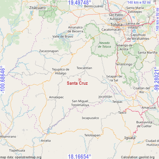
Santa Cruz GPS coordinates[2]
18° 49' 59.988" North, 99° 58' 59.988" West
| Map corner | latitude | longitude |
|---|---|---|
| Upper-left | 19.49748°, | -100.68646° |
| Center: | 18.83333°, | -99.98333° |
| Lower-right: | 18.16654°, | -99.28021° |
| Map W x H: | 148×148 km | = 92×92mi |
| max Lat: | 32.7° ⇑68.2% North |
| Santa Cruz: | 18.83333° |
| min Lat: | ⇓31.8% South 14.53588° |
| min Long | Santa Cruz | max Long |
| -117.105° | -99.98333° | -86.73105° |
| W 36.2%⇐ | ⇒63.8% E |
Elevation
Elevation of Santa Cruz is 1919 m = 6296 ft, and this is 665.3 m = 2183 ft above average elevation for this country.
| Max E: |
3497 m = 11473 ft | 30.3% |
| Santa Cruz | 1919 m 6296 ft | |
| Avg. | 1253.7 m = 4113 ft | |
Min E: |
-1 m = -3 ft | 69.7% |
See also: Mexico elevation on elevation.city.
Geographical zone
Santa Cruz is located in North Torrid zone (between Equator and Tropic of Cancer). Distance of this Northern Tropic circle is 511.8 km =318 mi to North.| Distance of | km | miles | from Santa Cruz |
|---|---|---|---|
| North Pole | 7913 | 4916.9 | to North |
| Arctic Circle | 5307.1 | 3297.7 | to North |
| Tropic Cancer | 511.8 | 318 | to North |
| Equator | 2094.1 | 1301.2 | to South |


Nearby cities:
15 places around Santa Cruz: (largest is in red/bold)
• Acatitlán
10.5 km =6.5 mi,  19°
19°
• Almoloya de Alquisiras
10 km =6.2 mi,  68°
68°
• Atzumpa
8.6 km =5.3 mi,  145°
145°
• Capula
4.7 km =2.9 mi,  30°
30°
• Cuauhtenco
10.7 km =6.6 mi,  76°
76°
• Diego Sánchez
3.4 km =2.1 mi,  98°
98°
• Hueyatenco
6.4 km =4 mi,  14°
14°
• Pantoja
6 km =3.7 mi,  322°
322°
• Plan de Vigas
11.3 km =7 mi,  106°
106°
• San Andrés Ocotepec
10.3 km =6.4 mi, 319°
• San Andrés Tepetitlán
9.9 km =6.2 mi,  42°
42°
• San Francisco
10.1 km =6.3 mi, 34°
• San Isidro Xochitla
5.8 km =3.6 mi,  219°
219°
• Sultepec
3.4 km =2.1 mi, 33°
• Texcaltitlán
11.8 km =7.3 mi, 23°
Sources, notices
• [Note1] Compared only with cities in Mexico existing in our database
• [Src1] Map data: © OpenStreetMap contributors (CC-BY-SA)
• [Src2] Other city data from geonames.org with taken over terms of usage.
• [Src3] Geographical zone / Annual Mean Temperature by Robert A. Rohde @ Wikipedia
