Atzumpa geodata
Atzumpa (State of Mexico) is a populated place; located in Mexico in America/Mexico_City (GMT-6) time zone. With population of 520 people, there are 16208 cities with bigger population in this country. Compared to other cities in Mexico, 69.2% of cities are located further ↑North; 63.1% of cities are located further →East and 55.7% of cities have lower elevation than Atzumpa. Note1


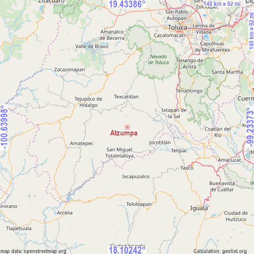
Atzumpa GPS coordinates[2]
18° 46' 10.02" North, 99° 56' 12.66" West
| Map corner | latitude | longitude |
|---|---|---|
| Upper-left | 19.43386°, | -100.63998° |
| Center: | 18.76945°, | -99.93685° |
| Lower-right: | 18.10242°, | -99.23373° |
| Map W x H: | 148×148 km | = 92×92mi |
| max Lat: | 32.7° ⇑69.2% North |
| Atzumpa: | 18.76945° |
| min Lat: | ⇓30.8% South 14.53588° |
| min Long | Atzumpa | max Long |
| -117.105° | -99.93685° | -86.73105° |
| W 36.9%⇐ | ⇒63.1% E |
Elevation
Elevation of Atzumpa is 1608 m = 5276 ft, and this is 354.3 m = 1162 ft above average elevation for this country.
| Max E: |
3497 m = 11473 ft | 44.3% |
| Atzumpa | 1608 m 5276 ft | |
| Avg. | 1253.7 m = 4113 ft | |
Min E: |
-1 m = -3 ft | 55.7% |
See also: Mexico elevation on elevation.city.
Geographical zone
Atzumpa is located in North Torrid zone (between Equator and Tropic of Cancer). Distance of this Northern Tropic circle is 519 km =322.5 mi to North.| Distance of | km | miles | from Atzumpa |
|---|---|---|---|
| North Pole | 7920.1 | 4921.3 | to North |
| Arctic Circle | 5314.2 | 3302.1 | to North |
| Tropic Cancer | 519 | 322.5 | to North |
| Equator | 2087 | 1296.8 | to South |


Nearby cities:
15 places around Atzumpa: (largest is in red/bold)
• Agua Fría
12.2 km =7.6 mi,  32°
32°
• Almoloya de Alquisiras
11.6 km =7.2 mi,  22°
22°
• Capula
11.5 km =7.1 mi,  347°
347°
• Cuauhtenco
11.1 km =6.9 mi, 30°
• Diego Sánchez
6.8 km =4.2 mi, 347°
• Hueyatenco
13.6 km =8.5 mi, 346°
• Huitzoltepec
14.4 km =8.9 mi,  90°
90°
• Jalpan (Jalpa)
13.9 km =8.6 mi,  201°
201°
• Plan de Vigas
7.1 km =4.4 mi,  57°
57°
• Potzontepec
5.8 km =3.6 mi,  127°
127°
• San Andrés Tepetitlán
14.4 km =8.9 mi,  7°
7°
• San Isidro Xochitla
9 km =5.6 mi,  287°
287°
• San Pedro Hueyahualco
10.8 km =6.7 mi, 203°
• Santa Cruz
8.6 km =5.3 mi,  325°
325°
• Sultepec
10.4 km =6.5 mi,  342°
342°
Sources, notices
• [Note1] Compared only with cities in Mexico existing in our database
• [Src1] Map data: © OpenStreetMap contributors (CC-BY-SA)
• [Src2] Other city data from geonames.org with taken over terms of usage.
• [Src3] Geographical zone / Annual Mean Temperature by Robert A. Rohde @ Wikipedia
