Ixcamilpa geodata
Ixcamilpa (Guerrero) is a seat of a second-order administrative division; located in Mexico in America/Mexico_City (GMT-6) time zone. With population of 1,354 people, there are 6424 cities with bigger population in this country. Compared to other cities in Mexico, 78.3% of cities are located further ↑North; 55.2% of cities are located further ←West and 64.4% of cities have higher elevation than Ixcamilpa. Note1


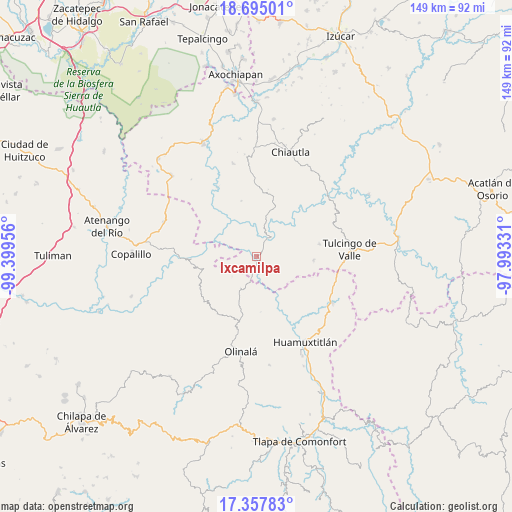
Ixcamilpa GPS coordinates[2]
18° 1' 39.684" North, 98° 41' 47.148" West
| Map corner | latitude | longitude |
|---|---|---|
| Upper-left | 18.69501°, | -99.39956° |
| Center: | 18.02769°, | -98.69643° |
| Lower-right: | 17.35783°, | -97.99331° |
| Map W x H: | 148.7×148.7 km | = 92.4×92.4mi |
| max Lat: | 32.7° ⇑78.3% North |
| Ixcamilpa: | 18.02769° |
| min Lat: | ⇓21.7% South 14.53588° |
| min Long | Ixcamilpa | max Long |
| -117.105° | -98.69643° | -86.73105° |
| W 55.2%⇐ | ⇒44.8% E |
Elevation
Elevation of Ixcamilpa is 720 m = 2362 ft, and this is 533.7 m = 1751 ft below average elevation for this country.
| Max E: |
3497 m = 11473 ft | 64.4% |
| Avg. | 1253.7 m = 4113 ft | |
| Ixcamilpa | 720 m = 2362 ft | |
Min E: |
-1 m = -3 ft | 35.6% |
See also: Mexico elevation on elevation.city.
Geographical zone
Ixcamilpa is located in North Torrid zone (between Equator and Tropic of Cancer). Distance of this Northern Tropic circle is 601.4 km =373.7 mi to North.| Distance of | km | miles | from Ixcamilpa |
|---|---|---|---|
| North Pole | 8002.6 | 4972.6 | to North |
| Arctic Circle | 5396.7 | 3353.4 | to North |
| Tropic Cancer | 601.4 | 373.7 | to North |
| Equator | 2004.5 | 1245.5 | to South |


Nearby cities:
15 places around Ixcamilpa: (largest is in red/bold)
• Acaxtlahuacán de Albino Zertuche
16.6 km =10.3 mi,  94°
94°
• Ahuacatlán
13 km =8.1 mi,  191°
191°
• Amatlicha
25 km =15.5 mi,  206°
206°
• Chila de la Sal
24.1 km =15 mi,  67°
67°
• Coacalco
5.7 km =3.5 mi,  32°
32°
• Mezquitlán
25.3 km =15.7 mi,  268°
268°
• Pilcaya (San Juan Pilcaya)
23.3 km =14.5 mi,  357°
357°
• San Antonio Coyahuacán
18.5 km =11.5 mi,  174°
174°
• San Miguel Comitlipa
16.8 km =10.4 mi,  114°
114°
• Santa Cruz Lomalapa (Lomalapa)
12.8 km =8 mi, 168°
• Santa Mónica
23.1 km =14.4 mi,  330°
330°
• Tepetlacingo
13.8 km =8.6 mi, 210°
• Toltecamila
11 km =6.8 mi,  131°
131°
• Xicotlán
18.5 km =11.5 mi,  79°
79°
• Zumpango
10.4 km =6.5 mi, 172°
Sources, notices
• [Note1] Compared only with cities in Mexico existing in our database
• [Src1] Map data: © OpenStreetMap contributors (CC-BY-SA)
• [Src2] Other city data from geonames.org with taken over terms of usage.
• [Src3] Geographical zone / Annual Mean Temperature by Robert A. Rohde @ Wikipedia
