Ukúm geodata
Ukúm (Campeche) is a populated place; located in Mexico in America/Cancun (GMT-5) time zone. With population of 2,019 people, there are 4304 cities with bigger population in this country. Compared to other cities in Mexico, 60.1% of cities are located further ↑North; 98.4% of cities are located further ←West and 78% of cities have higher elevation than Ukúm. Note1


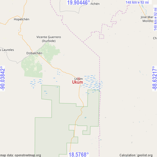
Ukúm GPS coordinates[2]
19° 14' 31.092" North, 89° 20' 7.044" West
| Map corner | latitude | longitude |
|---|---|---|
| Upper-left | 19.90446°, | -90.03842° |
| Center: | 19.24197°, | -89.33529° |
| Lower-right: | 18.5768°, | -88.63217° |
| Map W x H: | 147.6×147.6 km | = 91.7×91.7mi |
| max Lat: | 32.7° ⇑60.1% North |
| Ukúm: | 19.24197° |
| min Lat: | ⇓39.9% South 14.53588° |
| min Long | Ukúm | max Long |
| -117.105° | -89.33529° | -86.73105° |
| W 98.4%⇐ | ⇒1.6% E |
Elevation
Elevation of Ukúm is 131 m = 430 ft, and this is 1122.7 m = 3683 ft below average elevation for this country.
| Max E: |
3497 m = 11473 ft | 78% |
| Avg. | 1253.7 m = 4113 ft | |
| Ukúm | 131 m = 430 ft | |
Min E: |
-1 m = -3 ft | 22% |
See also: Mexico elevation on elevation.city.
Geographical zone
Ukúm is located in North Torrid zone (between Equator and Tropic of Cancer). Distance of this Northern Tropic circle is 466.4 km =289.8 mi to North.| Distance of | km | miles | from Ukúm |
|---|---|---|---|
| North Pole | 7867.6 | 4888.7 | to North |
| Arctic Circle | 5261.7 | 3269.5 | to North |
| Tropic Cancer | 466.4 | 289.8 | to North |
| Equator | 2139.5 | 1329.4 | to South |


Nearby cities:
15 places around Ukúm: (largest is in red/bold)
• Becanchén
71.4 km =44.4 mi,  9°
9°
• Cancabchén
32.2 km =20 mi,  282°
282°
• Candelaria
67.7 km =42.1 mi,  35°
35°
• Chunchintok
29.1 km =18.1 mi,  297°
297°
• Dzibalchén
48 km =29.8 mi, 300°
• Iturbide
46.8 km =29.1 mi,  323°
323°
• Kancabchén
72.3 km =44.9 mi, 43°
• Konchén
66.8 km =41.5 mi,  305°
305°
• Miguel Alemán
44.5 km =27.7 mi,  145°
145°
• Nuevo Becar
61.4 km =38.2 mi,  159°
159°
• Othón P. Blanco
54.5 km =33.9 mi, 39°
• Puerto Arturo
54.3 km =33.7 mi,  31°
31°
• Santa Rita
72.3 km =44.9 mi, 308°
• Xcupil
72.4 km =45 mi, 310°
• Xmabén
2.3 km =1.4 mi,  108°
108°
Sources, notices
• [Note1] Compared only with cities in Mexico existing in our database
• [Src1] Map data: © OpenStreetMap contributors (CC-BY-SA)
• [Src2] Other city data from geonames.org with taken over terms of usage.
• [Src3] Geographical zone / Annual Mean Temperature by Robert A. Rohde @ Wikipedia
