El Naranjo geodata
El Naranjo (Guerrero) is a populated place; located in Mexico in America/Mexico_City (GMT-6) time zone. With population of 813 people, there are 10742 cities with bigger population in this country. Compared to other cities in Mexico, 81.3% of cities are located further ↑North; 60.7% of cities are located further →East and 54.3% of cities have higher elevation than El Naranjo. Note1


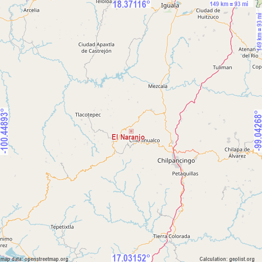
El Naranjo GPS coordinates[2]
17° 42' 9.324" North, 99° 44' 44.88" West
| Map corner | latitude | longitude |
|---|---|---|
| Upper-left | 18.37116°, | -100.44893° |
| Center: | 17.70259°, | -99.7458° |
| Lower-right: | 17.03152°, | -99.04268° |
| Map W x H: | 149×149 km | = 92.6×92.6mi |
| max Lat: | 32.7° ⇑81.3% North |
| El Naranjo: | 17.70259° |
| min Lat: | ⇓18.7% South 14.53588° |
| min Long | El Naranjo | max Long |
| -117.105° | -99.7458° | -86.73105° |
| W 39.3%⇐ | ⇒60.7% E |
Elevation
Elevation of El Naranjo is 1227 m = 4026 ft, and this is 26.7 m = 88 ft below average elevation for this country.
| Max E: |
3497 m = 11473 ft | 54.3% |
| Avg. | 1253.7 m = 4113 ft | |
| El Naranjo | 1227 m = 4026 ft | |
Min E: |
-1 m = -3 ft | 45.7% |
See also: Mexico elevation on elevation.city.
Geographical zone
El Naranjo is located in North Torrid zone (between Equator and Tropic of Cancer). Distance of this Northern Tropic circle is 637.6 km =396.2 mi to North.| Distance of | km | miles | from El Naranjo |
|---|---|---|---|
| North Pole | 8038.7 | 4995 | to North |
| Arctic Circle | 5432.8 | 3375.8 | to North |
| Tropic Cancer | 637.6 | 396.2 | to North |
| Equator | 1968.3 | 1223 | to South |


Nearby cities:
15 places around El Naranjo: (largest is in red/bold)
• Atlixtac
13.8 km =8.6 mi,  117°
117°
• Campo de Aviación
9.3 km =5.8 mi,  237°
237°
• Carrizal de Bravo
13.4 km =8.3 mi,  226°
226°
• Carrizalillo
16.8 km =10.4 mi,  12°
12°
• Chichihualco
8.8 km =5.5 mi, 123°
• El Balzamar
15.8 km =9.8 mi,  205°
205°
• El Palmar
16.2 km =10.1 mi,  111°
111°
• Huerta Vieja
21.1 km =13.1 mi,  263°
263°
• Iyotla
9 km =5.6 mi,  181°
181°
• La Ciénega
18.8 km =11.7 mi,  313°
313°
• La Venta
20.8 km =12.9 mi, 305°
• Las Vinatas
20.8 km =12.9 mi,  327°
327°
• Puerto General Nicolás Bravo (Filo de Caballos)
12 km =7.5 mi, 239°
• Tepozonalco
11.1 km =6.9 mi, 177°
• Xochipala
16.5 km =10.3 mi,  42°
42°
Sources, notices
• [Note1] Compared only with cities in Mexico existing in our database
• [Src1] Map data: © OpenStreetMap contributors (CC-BY-SA)
• [Src2] Other city data from geonames.org with taken over terms of usage.
• [Src3] Geographical zone / Annual Mean Temperature by Robert A. Rohde @ Wikipedia
