Carrizalillo geodata
Carrizalillo (Guerrero) is a populated place; located in Mexico in America/Mexico_City (GMT-6) time zone. With population of 1,200 people, there are 7242 cities with bigger population in this country. Compared to other cities in Mexico, 80.1% of cities are located further ↑North; 60.4% of cities are located further →East and 51.9% of cities have lower elevation than Carrizalillo. Note1


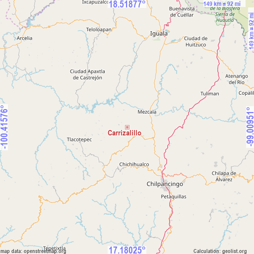
Carrizalillo GPS coordinates[2]
17° 51' 2.772" North, 99° 42' 45.468" West
| Map corner | latitude | longitude |
|---|---|---|
| Upper-left | 18.51877°, | -100.41576° |
| Center: | 17.85077°, | -99.71263° |
| Lower-right: | 17.18025°, | -99.00951° |
| Map W x H: | 148.8×148.8 km | = 92.5×92.5mi |
| max Lat: | 32.7° ⇑80.1% North |
| Carrizalillo: | 17.85077° |
| min Lat: | ⇓19.9% South 14.53588° |
| min Long | Carrizalillo | max Long |
| -117.105° | -99.71263° | -86.73105° |
| W 39.6%⇐ | ⇒60.4% E |
Elevation
Elevation of Carrizalillo is 1520 m = 4987 ft, and this is 266.3 m = 874 ft above average elevation for this country.
| Max E: |
3497 m = 11473 ft | 48.1% |
| Carrizalillo | 1520 m 4987 ft | |
| Avg. | 1253.7 m = 4113 ft | |
Min E: |
-1 m = -3 ft | 51.9% |
See also: Mexico elevation on elevation.city.
Geographical zone
Carrizalillo is located in North Torrid zone (between Equator and Tropic of Cancer). Distance of this Northern Tropic circle is 621.1 km =385.9 mi to North.| Distance of | km | miles | from Carrizalillo |
|---|---|---|---|
| North Pole | 8022.2 | 4984.8 | to North |
| Arctic Circle | 5416.4 | 3365.6 | to North |
| Tropic Cancer | 621.1 | 385.9 | to North |
| Equator | 1984.8 | 1233.3 | to South |


Nearby cities:
15 places around Carrizalillo: (largest is in red/bold)
• Acatlán del Río
21.9 km =13.6 mi,  295°
295°
• Atzcala
15.1 km =9.4 mi,  20°
20°
• Campo de Aviación
24.3 km =15.1 mi,  207°
207°
• Chichihualco
21.7 km =13.5 mi,  169°
169°
• El Naranjo
16.8 km =10.4 mi,  192°
192°
• La Ciénega
17.6 km =10.9 mi,  258°
258°
• La Venta
21 km =13 mi, 257°
• Las Vinatas
14.7 km =9.1 mi,  273°
273°
• Mezcala
14.8 km =9.2 mi,  52°
52°
• Nuevo Balsas
20.8 km =12.9 mi,  346°
346°
• San Juan Tetelcingo
22 km =13.7 mi,  68°
68°
• Tlacotenco
24.3 km =15.1 mi,  251°
251°
• Tlamamacan
21.3 km =13.2 mi, 67°
• Xalitla
24.1 km =15 mi, 47°
• Xochipala
8.8 km =5.5 mi,  119°
119°
Sources, notices
• [Note1] Compared only with cities in Mexico existing in our database
• [Src1] Map data: © OpenStreetMap contributors (CC-BY-SA)
• [Src2] Other city data from geonames.org with taken over terms of usage.
• [Src3] Geographical zone / Annual Mean Temperature by Robert A. Rohde @ Wikipedia
