Marquelia geodata
Marquelia (Guerrero) is a seat of a second-order administrative division; located in Mexico in America/Mexico_City (GMT-6) time zone. With population of 6,553 people, there are 1429 cities with bigger population in this country. Compared to other cities in Mexico, 93.8% of cities are located further ↑North; 53.3% of cities are located further ←West and 95.1% of cities have higher elevation than Marquelia. Note1


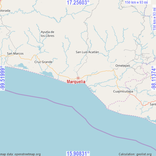
Marquelia GPS coordinates[2]
16° 35' 0.06" North, 98° 49' 0.696" West
| Map corner | latitude | longitude |
|---|---|---|
| Upper-left | 17.25603°, | -99.51999° |
| Center: | 16.58335°, | -98.81686° |
| Lower-right: | 15.90831°, | -98.11374° |
| Map W x H: | 149.9×149.9 km | = 93.1×93.1mi |
| max Lat: | 32.7° ⇑93.8% North |
| Marquelia: | 16.58335° |
| min Lat: | ⇓6.2% South 14.53588° |
| min Long | Marquelia | max Long |
| -117.105° | -98.81686° | -86.73105° |
| W 53.3%⇐ | ⇒46.7% E |
Elevation
Elevation of Marquelia is 13 m = 43 ft, and this is 1240.7 m = 4071 ft below average elevation for this country.
| Max E: |
3497 m = 11473 ft | 95.1% |
| Avg. | 1253.7 m = 4113 ft | |
| Marquelia | 13 m = 43 ft | |
Min E: |
-1 m = -3 ft | 4.9% |
See also: Mexico elevation on elevation.city.
Geographical zone
Marquelia is located in North Torrid zone (between Equator and Tropic of Cancer). Distance of this Northern Tropic circle is 762 km =473.5 mi to North.| Distance of | km | miles | from Marquelia |
|---|---|---|---|
| North Pole | 8163.2 | 5072.4 | to North |
| Arctic Circle | 5557.3 | 3453.1 | to North |
| Tropic Cancer | 762 | 473.5 | to North |
| Equator | 1843.9 | 1145.7 | to South |


Nearby cities:
15 places around Marquelia: (largest is in red/bold)
• Agua Zarca
13 km =8.1 mi,  69°
69°
• Atrixco
13.8 km =8.6 mi,  294°
294°
• Barra de Tecoanapa
12.3 km =7.6 mi,  132°
132°
• Carrizalillo
6.4 km =4 mi,  63°
63°
• Copala
17.4 km =10.8 mi,  278°
278°
• El Capulín Chocolate
11 km =6.8 mi,  33°
33°
• El Coquillo
20 km =12.4 mi,  322°
322°
• El Llano
19.3 km =12 mi,  311°
311°
• El Polvorín
1.7 km =1.1 mi,  108°
108°
• Islaltepec (Las Parotas)
2.5 km =1.6 mi,  256°
256°
• Jolotichán
20.9 km =13 mi, 26°
• Juchitán
19.4 km =12.1 mi,  76°
76°
• San Isidro el Puente (El Puente)
21.7 km =13.5 mi, 68°
• Tepantitlán
5.5 km =3.4 mi,  345°
345°
• Zoyatlán
16.6 km =10.3 mi, 32°
Sources, notices
• [Note1] Compared only with cities in Mexico existing in our database
• [Src1] Map data: © OpenStreetMap contributors (CC-BY-SA)
• [Src2] Other city data from geonames.org with taken over terms of usage.
• [Src3] Geographical zone / Annual Mean Temperature by Robert A. Rohde @ Wikipedia
