El Polvorín geodata
El Polvorín (Guerrero) is a populated place; located in Mexico in America/Mexico_City (GMT-6) time zone. With population of 1,415 people, there are 6109 cities with bigger population in this country. Compared to other cities in Mexico, 93.8% of cities are located further ↑North; 53.6% of cities are located further ←West and 88.6% of cities have higher elevation than El Polvorín. Note1


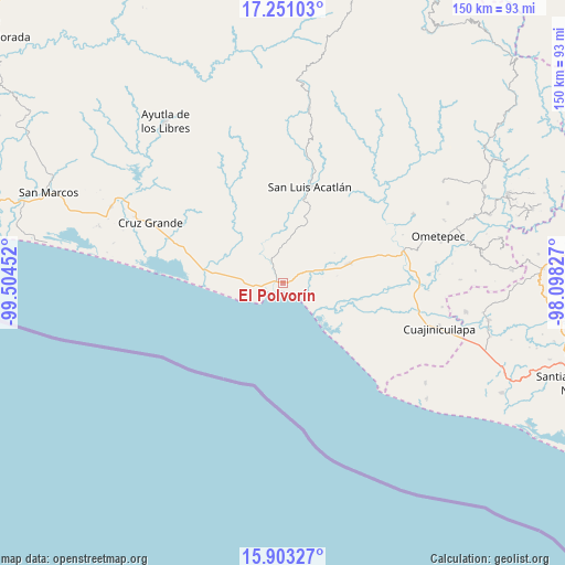
El Polvorín GPS coordinates[2]
16° 34' 41.988" North, 98° 48' 5.004" West
| Map corner | latitude | longitude |
|---|---|---|
| Upper-left | 17.25103°, | -99.50452° |
| Center: | 16.57833°, | -98.80139° |
| Lower-right: | 15.90327°, | -98.09827° |
| Map W x H: | 149.9×149.9 km | = 93.1×93.1mi |
| max Lat: | 32.7° ⇑93.8% North |
| El Polvorín: | 16.57833° |
| min Lat: | ⇓6.2% South 14.53588° |
| min Long | El Polvorín | max Long |
| -117.105° | -98.80139° | -86.73105° |
| W 53.6%⇐ | ⇒46.4% E |
Elevation
Elevation of El Polvorín is 28 m = 92 ft, and this is 1225.7 m = 4021 ft below average elevation for this country.
| Max E: |
3497 m = 11473 ft | 88.6% |
| Avg. | 1253.7 m = 4113 ft | |
| El Polvorín | 28 m = 92 ft | |
Min E: |
-1 m = -3 ft | 11.4% |
See also: Mexico elevation on elevation.city.
Geographical zone
El Polvorín is located in North Torrid zone (between Equator and Tropic of Cancer). Distance of this Northern Tropic circle is 762.6 km =473.9 mi to North.| Distance of | km | miles | from El Polvorín |
|---|---|---|---|
| North Pole | 8163.7 | 5072.7 | to North |
| Arctic Circle | 5557.8 | 3453.5 | to North |
| Tropic Cancer | 762.6 | 473.9 | to North |
| Equator | 1843.3 | 1145.4 | to South |


Nearby cities:
15 places around El Polvorín: (largest is in red/bold)
• Agua Zarca
11.7 km =7.3 mi,  64°
64°
• Atrixco
15.6 km =9.7 mi,  293°
293°
• Barra de Tecoanapa
10.7 km =6.6 mi,  136°
136°
• Carrizalillo
5.3 km =3.3 mi,  50°
50°
• Copala
19.1 km =11.9 mi,  279°
279°
• El Capulín Chocolate
10.7 km =6.6 mi,  24°
24°
• El Coquillo
21.5 km =13.4 mi,  319°
319°
• El Llano
20.9 km =13 mi,  309°
309°
• Islaltepec (Las Parotas)
4.1 km =2.5 mi,  269°
269°
• Jolotichán
20.8 km =12.9 mi, 21°
• Juchitán
17.9 km =11.1 mi,  73°
73°
• Marquelia
1.7 km =1.1 mi, 288°
• San Isidro el Puente (El Puente)
20.4 km =12.7 mi, 65°
• Tepantitlán
6.6 km =4.1 mi,  332°
332°
• Zoyatlán
16.2 km =10.1 mi,  26°
26°
Sources, notices
• [Note1] Compared only with cities in Mexico existing in our database
• [Src1] Map data: © OpenStreetMap contributors (CC-BY-SA)
• [Src2] Other city data from geonames.org with taken over terms of usage.
• [Src3] Geographical zone / Annual Mean Temperature by Robert A. Rohde @ Wikipedia
