Llano Grande geodata
Llano Grande (Veracruz) is a populated place; located in Mexico in America/Mexico_City (GMT-6) time zone. With population of 1,405 people, there are 6164 cities with bigger population in this country. Compared to other cities in Mexico, 57% of cities are located further ↑North; 76.3% of cities are located further ←West and 62.8% of cities have higher elevation than Llano Grande. Note1


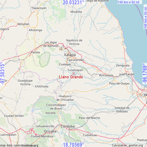
Llano Grande GPS coordinates[2]
19° 22' 13.26" North, 96° 52' 48.072" West
| Map corner | latitude | longitude |
|---|---|---|
| Upper-left | 20.03231°, | -97.58315° |
| Center: | 19.37035°, | -96.88002° |
| Lower-right: | 18.70569°, | -96.1769° |
| Map W x H: | 147.5×147.5 km | = 91.7×91.7mi |
| max Lat: | 32.7° ⇑57% North |
| Llano Grande: | 19.37035° |
| min Lat: | ⇓43% South 14.53588° |
| min Long | Llano Grande | max Long |
| -117.105° | -96.88002° | -86.73105° |
| W 76.3%⇐ | ⇒23.7% E |
Elevation
Elevation of Llano Grande is 836 m = 2743 ft, and this is 417.7 m = 1370 ft below average elevation for this country.
| Max E: |
3497 m = 11473 ft | 62.8% |
| Avg. | 1253.7 m = 4113 ft | |
| Llano Grande | 836 m = 2743 ft | |
Min E: |
-1 m = -3 ft | 37.2% |
See also: Mexico elevation on elevation.city.
Geographical zone
Llano Grande is located in North Torrid zone (between Equator and Tropic of Cancer). Distance of this Northern Tropic circle is 452.1 km =280.9 mi to North.| Distance of | km | miles | from Llano Grande |
|---|---|---|---|
| North Pole | 7853.3 | 4879.8 | to North |
| Arctic Circle | 5247.4 | 3260.6 | to North |
| Tropic Cancer | 452.1 | 280.9 | to North |
| Equator | 2153.8 | 1338.3 | to South |


Nearby cities:
15 places around Llano Grande: (largest is in red/bold)
• Alborada
8.7 km =5.4 mi,  6°
6°
• Bella Esperanza
7.1 km =4.4 mi, 11°
• El Grande
8 km =5 mi,  331°
331°
• Estación Chavarrillo
9.8 km =6.1 mi,  48°
48°
• Independencia
7.2 km =4.5 mi,  284°
284°
• La Reforma
7.8 km =4.8 mi,  230°
230°
• Las Lomas
9 km =5.6 mi,  342°
342°
• Limones
5.8 km =3.6 mi, 231°
• Mahuixtlan
5.9 km =3.7 mi,  317°
317°
• Monte Blanco
5.3 km =3.3 mi, 278°
• Piedra Parada
8.8 km =5.5 mi,  252°
252°
• Teocelo
10 km =6.2 mi, 279°
• Tlaltetela
6.6 km =4.1 mi,  199°
199°
• Tuzamapan
4 km =2.5 mi,  25°
25°
• Vaquería
9.9 km =6.2 mi, 233°
Sources, notices
• [Note1] Compared only with cities in Mexico existing in our database
• [Src1] Map data: © OpenStreetMap contributors (CC-BY-SA)
• [Src2] Other city data from geonames.org with taken over terms of usage.
• [Src3] Geographical zone / Annual Mean Temperature by Robert A. Rohde @ Wikipedia
