Tamiapa geodata
Tamiapa (Sinaloa) is a populated place; located in Mexico in America/Mazatlan (GMT-7) time zone. With population of 623 people, there are 13874 cities with bigger population in this country. Compared to other cities in Mexico, 93.3% of cities are located further ↓South; 94.8% of cities are located further →East and 59.6% of cities have higher elevation than Tamiapa. Note1


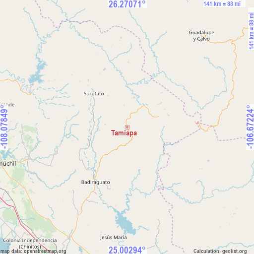
Tamiapa GPS coordinates[2]
25° 38' 18.636" North, 107° 22' 31.296" West
| Map corner | latitude | longitude |
|---|---|---|
| Upper-left | 26.27071°, | -108.07849° |
| Center: | 25.63851°, | -107.37536° |
| Lower-right: | 25.00294°, | -106.67224° |
| Map W x H: | 141×141 km | = 87.6×87.6mi |
| max Lat: | 32.7° ⇑6.7% North |
| Tamiapa: | 25.63851° |
| min Lat: | ⇓93.3% South 14.53588° |
| min Long | Tamiapa | max Long |
| -117.105° | -107.37536° | -86.73105° |
| W 5.2%⇐ | ⇒94.8% E |
Elevation
Elevation of Tamiapa is 1020 m = 3346 ft, and this is 233.7 m = 767 ft below average elevation for this country.
| Max E: |
3497 m = 11473 ft | 59.6% |
| Avg. | 1253.7 m = 4113 ft | |
| Tamiapa | 1020 m = 3346 ft | |
Min E: |
-1 m = -3 ft | 40.4% |
See also: Mexico elevation on elevation.city.
Geographical zone
Tamiapa is located in North temperate zone (between Tropic of Cancer and the Arctic Circle). Distance of this Northern Tropic circle is 244.8 km =152.1 mi to South.| Distance of | km | miles | from Tamiapa |
|---|---|---|---|
| North Pole | 7156.3 | 4446.7 | to North |
| Arctic Circle | 4550.4 | 2827.5 | to North |
| Tropic Cancer | 244.8 | 152.1 | to South |
| Equator | 2850.7 | 1771.3 | to South |


Nearby cities:
15 places around Tamiapa: (largest is in red/bold)
• Bacubirito
57.3 km =35.6 mi,  289°
289°
• Badiraguato
35.1 km =21.8 mi,  210°
210°
• Caitime
67.1 km =41.7 mi,  239°
239°
• Cerro Agudo
59.1 km =36.7 mi,  265°
265°
• Dolores
43.3 km =26.9 mi,  28°
28°
• El Durazno
48.7 km =30.3 mi,  112°
112°
• El Mezquite
49.9 km =31 mi, 266°
• Guadalupe y Calvo
65.1 km =40.5 mi,  39°
39°
• Higuera de los Vega
58.4 km =36.3 mi, 271°
• Jesús María
61.6 km =38.3 mi,  187°
187°
• Mocorito
57.3 km =35.6 mi,  252°
252°
• Otatillos
28 km =17.4 mi,  172°
172°
• San Benito
40.4 km =25.1 mi, 254°
• San José del Llano
17 km =10.6 mi,  13°
13°
• Surutato
26.3 km =16.3 mi,  315°
315°
Sources, notices
• [Note1] Compared only with cities in Mexico existing in our database
• [Src1] Map data: © OpenStreetMap contributors (CC-BY-SA)
• [Src2] Other city data from geonames.org with taken over terms of usage.
• [Src3] Geographical zone / Annual Mean Temperature by Robert A. Rohde @ Wikipedia
