Tacotlán geodata
Tacotlán (Jalisco) is a populated place; located in Mexico in America/Mexico_City (GMT-6) time zone. With population of 601 people, there are 14318 cities with bigger population in this country. Compared to other cities in Mexico, 73.6% of cities are located further ↓South; 86.5% of cities are located further →East and 57.8% of cities have lower elevation than Tacotlán. Note1


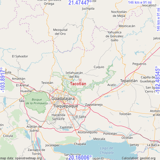
Tacotlán GPS coordinates[2]
20° 49' 7.32" North, 103° 11' 18.852" West
| Map corner | latitude | longitude |
|---|---|---|
| Upper-left | 21.47447°, | -103.8917° |
| Center: | 20.8187°, | -103.18857° |
| Lower-right: | 20.16006°, | -102.48545° |
| Map W x H: | 146.1×146.2 km | = 90.8×90.8mi |
| max Lat: | 32.7° ⇑26.4% North |
| Tacotlán: | 20.8187° |
| min Lat: | ⇓73.6% South 14.53588° |
| min Long | Tacotlán | max Long |
| -117.105° | -103.18857° | -86.73105° |
| W 13.5%⇐ | ⇒86.5% E |
Elevation
Elevation of Tacotlán is 1687 m = 5535 ft, and this is 433.3 m = 1422 ft above average elevation for this country.
| Max E: |
3497 m = 11473 ft | 42.2% |
| Tacotlán | 1687 m 5535 ft | |
| Avg. | 1253.7 m = 4113 ft | |
Min E: |
-1 m = -3 ft | 57.8% |
See also: Mexico elevation on elevation.city.
Geographical zone
Tacotlán is located in North Torrid zone (between Equator and Tropic of Cancer). Distance of this Northern Tropic circle is 291.1 km =180.9 mi to North.| Distance of | km | miles | from Tacotlán |
|---|---|---|---|
| North Pole | 7692.2 | 4779.7 | to North |
| Arctic Circle | 5086.4 | 3160.5 | to North |
| Tropic Cancer | 291.1 | 180.9 | to North |
| Equator | 2314.8 | 1438.3 | to South |


Nearby cities:
15 places around Tacotlán: (largest is in red/bold)
• Coyula
18.2 km =11.3 mi,  192°
192°
• Cuquío
20.8 km =12.9 mi,  53°
53°
• Ixtlahuacán del Río
7.4 km =4.6 mi,  313°
313°
• La Esperanza
18.4 km =11.4 mi,  69°
69°
• Mascuala
10.8 km =6.7 mi,  239°
239°
• Matatlán
12.8 km =8 mi,  161°
161°
• Nuevo Israel
15.7 km =9.8 mi,  211°
211°
• Palos Altos
6.9 km =4.3 mi,  32°
32°
• Residencias el Prado (Jardines del Prado)
15.2 km =9.4 mi, 191°
• San Antonio de los Vázquez
4.4 km =2.7 mi,  91°
91°
• San Esteban (San Miguel Tateposco)
19.4 km =12.1 mi,  263°
263°
• San Isidro
17.2 km =10.7 mi, 259°
• San Juan del Monte
12.6 km =7.8 mi, 30°
• Teponahuasco
18.5 km =11.5 mi,  57°
57°
• Trejos
2.8 km =1.7 mi,  198°
198°
Sources, notices
• [Note1] Compared only with cities in Mexico existing in our database
• [Src1] Map data: © OpenStreetMap contributors (CC-BY-SA)
• [Src2] Other city data from geonames.org with taken over terms of usage.
• [Src3] Geographical zone / Annual Mean Temperature by Robert A. Rohde @ Wikipedia
