Palos Altos geodata
Palos Altos (Jalisco) is a populated place; located in Mexico in America/Mexico_City (GMT-6) time zone. With population of 1,080 people, there are 8072 cities with bigger population in this country. Compared to other cities in Mexico, 74.3% of cities are located further ↓South; 86.3% of cities are located further →East and 63.1% of cities have lower elevation than Palos Altos. Note1


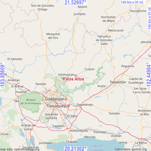
Palos Altos GPS coordinates[2]
20° 52' 17.148" North, 103° 9' 10.656" West
| Map corner | latitude | longitude |
|---|---|---|
| Upper-left | 21.52697°, | -103.85609° |
| Center: | 20.87143°, | -103.15296° |
| Lower-right: | 20.21302°, | -102.44984° |
| Map W x H: | 146.1×146.1 km | = 90.8×90.8mi |
| max Lat: | 32.7° ⇑25.7% North |
| Palos Altos: | 20.87143° |
| min Lat: | ⇓74.3% South 14.53588° |
| min Long | Palos Altos | max Long |
| -117.105° | -103.15296° | -86.73105° |
| W 13.7%⇐ | ⇒86.3% E |
Elevation
Elevation of Palos Altos is 1780 m = 5840 ft, and this is 526.3 m = 1727 ft above average elevation for this country.
| Max E: |
3497 m = 11473 ft | 36.9% |
| Palos Altos | 1780 m 5840 ft | |
| Avg. | 1253.7 m = 4113 ft | |
Min E: |
-1 m = -3 ft | 63.1% |
See also: Mexico elevation on elevation.city.
Geographical zone
Palos Altos is located in North Torrid zone (between Equator and Tropic of Cancer). Distance of this Northern Tropic circle is 285.2 km =177.2 mi to North.| Distance of | km | miles | from Palos Altos |
|---|---|---|---|
| North Pole | 7686.4 | 4776.1 | to North |
| Arctic Circle | 5080.5 | 3156.9 | to North |
| Tropic Cancer | 285.2 | 177.2 | to North |
| Equator | 2320.7 | 1442 | to South |


Nearby cities:
15 places around Palos Altos: (largest is in red/bold)
• Cuquío
14.6 km =9.1 mi,  63°
63°
• Ixtlahuacán del Río
9.1 km =5.7 mi,  264°
264°
• Juchitlán
21.6 km =13.4 mi,  29°
29°
• La Esperanza
13.5 km =8.4 mi,  87°
87°
• Las Cruces
17.4 km =10.8 mi,  13°
13°
• Lázaro Cárdenas
15.9 km =9.9 mi, 58°
• Mascuala
17.3 km =10.7 mi,  228°
228°
• Matatlán
18 km =11.2 mi,  179°
179°
• Residencias el Prado (Jardines del Prado)
21.9 km =13.6 mi,  198°
198°
• San Antonio de los Vázquez
6 km =3.7 mi,  173°
173°
• San Gabriel
21.8 km =13.5 mi,  41°
41°
• San Juan del Monte
5.7 km =3.5 mi, 28°
• Tacotlán
6.9 km =4.3 mi,  212°
212°
• Teponahuasco
12.5 km =7.8 mi,  70°
70°
• Trejos
9.7 km =6 mi, 208°
Sources, notices
• [Note1] Compared only with cities in Mexico existing in our database
• [Src1] Map data: © OpenStreetMap contributors (CC-BY-SA)
• [Src2] Other city data from geonames.org with taken over terms of usage.
• [Src3] Geographical zone / Annual Mean Temperature by Robert A. Rohde @ Wikipedia
