Santa Fé de la Laguna geodata
Santa Fé de la Laguna (Michoacán) is a populated place; located in Mexico in America/Mexico_City (GMT-6) time zone. With population of 4,879 people, there are 1894 cities with bigger population in this country. Compared to other cities in Mexico, 50.4% of cities are located further ↑North; 77.8% of cities are located further →East and 76.3% of cities have lower elevation than Santa Fé de la Laguna. Note1
Current local time in Santa Fé de la Laguna:
07:05 AM, WednesdayDifference from your time zone: hours


Santa Fé de la Laguna GPS coordinates[2]
19° 40' 21.252" North, 101° 33' 17.532" West
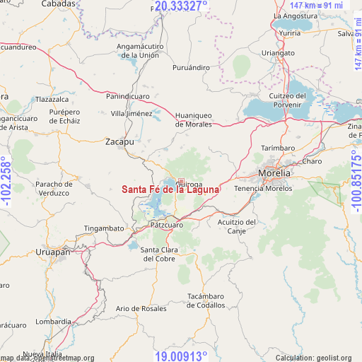
| Map corner | latitude | longitude |
|---|---|---|
| Upper-left | 20.33327°, | -102.258° |
| Center: | 19.67257°, | -101.55487° |
| Lower-right: | 19.00913°, | -100.85175° |
| Map W x H: | 147.2×147.2 km | = 91.5×91.5mi |
| max Lat: | 32.7° ⇑50.4% North |
| Santa Fé de la Laguna: | 19.67257° |
| min Lat: | ⇓49.6% South 14.53588° |
| min Long | Santa Fé de la | max Long |
| -117.105° | -101.55487° | -86.73105° |
| W 22.2%⇐ | ⇒77.8% E |
Elevation
Elevation of Santa Fé de la Laguna is 2053 m = 6736 ft, and this is 799.3 m = 2622 ft above average elevation for this country.
| Max E: |
3497 m = 11473 ft | 23.7% |
| Santa Fé de la Laguna | 2053 m 6736 ft | |
| Avg. | 1253.7 m = 4113 ft | |
Min E: |
-1 m = -3 ft | 76.3% |
See also: Mexico elevation on elevation.city.
Geographical zone
Santa Fé de la Laguna is located in North Torrid zone (between Equator and Tropic of Cancer). Distance of this Northern Tropic circle is 418.5 km =260 mi to North.| Distance of | km | miles | from Santa Fé de la Laguna |
|---|---|---|---|
| North Pole | 7819.7 | 4858.9 | to North |
| Arctic Circle | 5213.8 | 3239.7 | to North |
| Tropic Cancer | 418.5 | 260 | to North |
| Equator | 2187.4 | 1359.2 | to South |


Nearby cities:
15 places around Santa Fé de la Laguna: (largest is in red/bold)
• Aracurio
14.4 km =8.9 mi,  39°
39°
• Cucuchucho
12.8 km =8 mi,  218°
218°
• Fontezuelas
14.6 km =9.1 mi,  132°
132°
• Ihuatzio
13.4 km =8.3 mi,  208°
208°
• Janitzio
15 km =9.3 mi, 222°
• Matugeo
9.3 km =5.8 mi,  316°
316°
• Puácuaro
14.7 km =9.1 mi,  238°
238°
• Quiroga
3.4 km =2.1 mi,  103°
103°
• San Andrés Ziróndaro
8.1 km =5 mi,  267°
267°
• San Jerónimo Purenchecuaro
6.1 km =3.8 mi,  277°
277°
• Santiago Azajo
14.3 km =8.9 mi,  285°
285°
• Teremendo
14.8 km =9.2 mi,  32°
32°
• Tungüitiro
13.9 km =8.6 mi,  335°
335°
• Tzintzuntzán
5.5 km =3.4 mi, 206°
• Zipiajo
13.6 km =8.5 mi,  1°
1°
Sources, notices
• [Note1] Compared only with cities in Mexico existing in our database
• [Src1] Map data: © OpenStreetMap contributors (CC-BY-SA)
• [Src2] Other city data from geonames.org with taken over terms of usage.
• [Src3] Geographical zone / Annual Mean Temperature by Robert A. Rohde @ Wikipedia
