Quiroga geodata
Quiroga (Michoacán) is a seat of a second-order administrative division; located in Mexico in America/Mexico_City (GMT-6) time zone. With population of 14,669 people, there are 659 cities with bigger population in this country. Compared to other cities in Mexico, 50.6% of cities are located further ↑North; 77.6% of cities are located further →East and 77.7% of cities have lower elevation than Quiroga. Note1


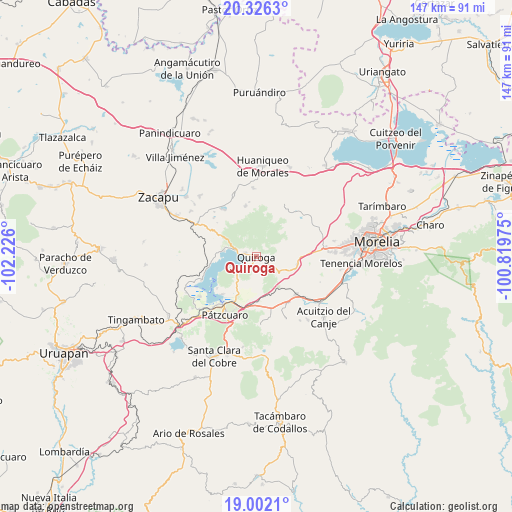
Quiroga GPS coordinates[2]
19° 39' 56.052" North, 101° 31' 22.332" West
| Map corner | latitude | longitude |
|---|---|---|
| Upper-left | 20.3263°, | -102.226° |
| Center: | 19.66557°, | -101.52287° |
| Lower-right: | 19.0021°, | -100.81975° |
| Map W x H: | 147.2×147.2 km | = 91.5×91.5mi |
| max Lat: | 32.7° ⇑50.6% North |
| Quiroga: | 19.66557° |
| min Lat: | ⇓49.4% South 14.53588° |
| min Long | Quiroga | max Long |
| -117.105° | -101.52287° | -86.73105° |
| W 22.4%⇐ | ⇒77.6% E |
Elevation
Elevation of Quiroga is 2083 m = 6834 ft, and this is 829.3 m = 2721 ft above average elevation for this country.
| Max E: |
3497 m = 11473 ft | 22.3% |
| Quiroga | 2083 m 6834 ft | |
| Avg. | 1253.7 m = 4113 ft | |
Min E: |
-1 m = -3 ft | 77.7% |
See also: Mexico elevation on elevation.city.
Geographical zone
Quiroga is located in North Torrid zone (between Equator and Tropic of Cancer). Distance of this Northern Tropic circle is 419.3 km =260.5 mi to North.| Distance of | km | miles | from Quiroga |
|---|---|---|---|
| North Pole | 7820.5 | 4859.4 | to North |
| Arctic Circle | 5214.6 | 3240.2 | to North |
| Tropic Cancer | 419.3 | 260.5 | to North |
| Equator | 2186.6 | 1358.7 | to South |


Nearby cities:
15 places around Quiroga: (largest is in red/bold)
• Aracurio
13.3 km =8.3 mi,  25°
25°
• Capula
13.8 km =8.6 mi,  86°
86°
• Cucuchucho
14.6 km =9.1 mi,  230°
230°
• El Correo
11.6 km =7.2 mi,  109°
109°
• Fontezuelas
11.7 km =7.3 mi,  140°
140°
• Ihuatzio
14.7 km =9.1 mi,  221°
221°
• Iratzio
11.8 km =7.3 mi,  100°
100°
• La Caja
12.8 km =8 mi,  133°
133°
• Matugeo
12.3 km =7.6 mi,  307°
307°
• San Andrés Ziróndaro
11.5 km =7.1 mi,  272°
272°
• San Jerónimo Purenchecuaro
9.5 km =5.9 mi,  279°
279°
• Santa Fé de la Laguna
3.4 km =2.1 mi, 283°
• Teremendo
14.1 km =8.8 mi,  18°
18°
• Tzintzuntzán
7.1 km =4.4 mi, 234°
• Zipiajo
14.7 km =9.1 mi,  347°
347°
Sources, notices
• [Note1] Compared only with cities in Mexico existing in our database
• [Src1] Map data: © OpenStreetMap contributors (CC-BY-SA)
• [Src2] Other city data from geonames.org with taken over terms of usage.
• [Src3] Geographical zone / Annual Mean Temperature by Robert A. Rohde @ Wikipedia
