Turuachi geodata
Turuachi (Chihuahua) is a populated place; located in Mexico in America/Chihuahua (GMT-6) time zone. With population of 1,131 people, there are 7664 cities with bigger population in this country. Compared to other cities in Mexico, 95.5% of cities are located further ↓South; 94.2% of cities are located further →East and 78.2% of cities have lower elevation than Turuachi. Note1


Turuachi GPS coordinates[2]
26° 7' 53.004" North, 106° 42' 15.012" West
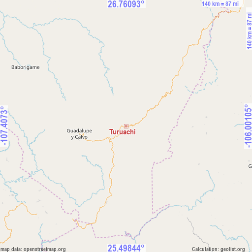
| Map corner | latitude | longitude |
|---|---|---|
| Upper-left | 26.76093°, | -107.4073° |
| Center: | 26.13139°, | -106.70417° |
| Lower-right: | 25.49844°, | -106.00105° |
| Map W x H: | 140.4×140.4 km | = 87.2×87.2mi |
| max Lat: | 32.7° ⇑4.5% North |
| Turuachi: | 26.13139° |
| min Lat: | ⇓95.5% South 14.53588° |
| min Long | Turuachi | max Long |
| -117.105° | -106.70417° | -86.73105° |
| W 5.8%⇐ | ⇒94.2% E |
Elevation
Elevation of Turuachi is 2093 m = 6867 ft, and this is 839.3 m = 2754 ft above average elevation for this country.
| Max E: |
3497 m = 11473 ft | 21.8% |
| Turuachi | 2093 m 6867 ft | |
| Avg. | 1253.7 m = 4113 ft | |
Min E: |
-1 m = -3 ft | 78.2% |
See also: Mexico elevation on elevation.city.
Geographical zone
Turuachi is located in North temperate zone (between Tropic of Cancer and the Arctic Circle). Distance of this Northern Tropic circle is 299.6 km =186.2 mi to South.| Distance of | km | miles | from Turuachi |
|---|---|---|---|
| North Pole | 7101.5 | 4412.7 | to North |
| Arctic Circle | 4495.6 | 2793.4 | to North |
| Tropic Cancer | 299.6 | 186.2 | to South |
| Equator | 2905.5 | 1805.4 | to South |


Nearby cities:
15 places around Turuachi: (largest is in red/bold)
• Arroyo de Lajas
45.8 km =28.5 mi,  117°
117°
• Baborigame
65.3 km =40.6 mi,  300°
300°
• Balleza
97.8 km =60.8 mi,  21°
21°
• Dolores
49.4 km =30.7 mi,  250°
250°
• Ejido El Vergel
49.5 km =30.8 mi,  40°
40°
• El Durazno
76.8 km =47.7 mi,  196°
196°
• Guachochi
85 km =52.8 mi,  334°
334°
• Guadalupe y Calvo
26.2 km =16.3 mi,  260°
260°
• Guanaceví
77.9 km =48.4 mi,  106°
106°
• Las Yerbitas [Aserradero]
9.4 km =5.8 mi,  232°
232°
• Mariano Balleza
98.1 km =61 mi, 21°
• San José del Llano
73.9 km =45.9 mi,  238°
238°
• San Pedro de Chinatú (Ranchería San Pedro)
10.2 km =6.3 mi,  53°
53°
• Surutato
92.9 km =57.7 mi, 247°
• Tamiapa
86.7 km =53.9 mi, 230°
Sources, notices
• [Note1] Compared only with cities in Mexico existing in our database
• [Src1] Map data: © OpenStreetMap contributors (CC-BY-SA)
• [Src2] Other city data from geonames.org with taken over terms of usage.
• [Src3] Geographical zone / Annual Mean Temperature by Robert A. Rohde @ Wikipedia
