San Pedro de Chinatú (Ranchería San Pedro) geodata
San Pedro de Chinatú (Ranchería San Pedro) (Chihuahua) is a populated place; located in Mexico in America/Chihuahua (GMT-6) time zone. With population of 540 people, there are 15727 cities with bigger population in this country. Compared to other cities in Mexico, 95.5% of cities are located further ↓South; 94.2% of cities are located further →East and 93.5% of cities have lower elevation than San Pedro de Chinatú (Ranchería San Pedro). Note1
Current local time in San Pedro de Chinatú (Ranchería San Pedro):
09:02 AM, MondayDifference from your time zone: hours


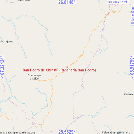
San Pedro de Chinatú (Ranchería San Pedro) GPS coordinates[2]
26° 11' 8.016" North, 106° 37' 15.996" West
| Map corner | latitude | longitude |
|---|---|---|
| Upper-left | 26.8148°, | -107.32424° |
| Center: | 26.18556°, | -106.62111° |
| Lower-right: | 25.5529°, | -105.91799° |
| Map W x H: | 140.3×140.3 km | = 87.2×87.2mi |
| max Lat: | 32.7° ⇑4.5% North |
| San Pedro de Chinatú (Ranchería San Pedro): | 26.18556° |
| min Lat: | ⇓95.5% South 14.53588° |
| min Long | San Pedro de Ch | max Long |
| -117.105° | -106.62111° | -86.73105° |
| W 5.8%⇐ | ⇒94.2% E |
Elevation
Elevation of San Pedro de Chinatú (Ranchería San Pedro) is 2552 m = 8373 ft, and this is 1298.3 m = 4260 ft above average elevation for this country.
| Max E: |
3497 m = 11473 ft | 6.5% |
| San Pedro de Chinatú (Ranchería San Pedro) | 2552 m 8373 ft | |
| Avg. | 1253.7 m = 4113 ft | |
Min E: |
-1 m = -3 ft | 93.5% |
See also: Mexico elevation on elevation.city.
Geographical zone
San Pedro de Chinatú (Ranchería San Pedro) is located in North temperate zone (between Tropic of Cancer and the Arctic Circle). Distance of this Northern Tropic circle is 305.6 km =189.9 mi to South.| Distance of | km | miles | from San Pedro de Chinatú (Ranchería San Pedro) |
|---|---|---|---|
| North Pole | 7095.5 | 4408.9 | to North |
| Arctic Circle | 4489.6 | 2789.7 | to North |
| Tropic Cancer | 305.6 | 189.9 | to South |
| Equator | 2911.6 | 1809.2 | to South |


Nearby cities:
15 places around San Pedro de Chinatú (Ranchería San Pedro): (largest is in red/bold)
• Arroyo de Lajas
42.2 km =26.2 mi,  129°
129°
• Baborigame
70 km =43.5 mi,  292°
292°
• Balleza
89.4 km =55.6 mi,  17°
17°
• Dolores
59.3 km =36.8 mi,  247°
247°
• Ejido El Vergel
39.6 km =24.6 mi,  36°
36°
• El Durazno
85.2 km =52.9 mi,  201°
201°
• El Tule
102.8 km =63.9 mi, 20°
• Guachochi
83.7 km =52 mi,  327°
327°
• Guadalupe y Calvo
35.7 km =22.2 mi, 252°
• Guanaceví
72.1 km =44.8 mi,  113°
113°
• Las Yerbitas [Aserradero]
19.7 km =12.2 mi,  233°
233°
• Mariano Balleza
89.7 km =55.7 mi, 17°
• San José del Llano
84.1 km =52.3 mi,  238°
238°
• Tamiapa
96.9 km =60.2 mi, 231°
• Turuachi
10.2 km =6.3 mi, 233°
Sources, notices
• [Note1] Compared only with cities in Mexico existing in our database
• [Src1] Map data: © OpenStreetMap contributors (CC-BY-SA)
• [Src2] Other city data from geonames.org with taken over terms of usage.
• [Src3] Geographical zone / Annual Mean Temperature by Robert A. Rohde @ Wikipedia
