Comachuén geodata
Comachuén (Michoacán) is a populated place; located in Mexico in America/Mexico_City (GMT-6) time zone. With population of 4,762 people, there are 1938 cities with bigger population in this country. Compared to other cities in Mexico, 52.6% of cities are located further ↑North; 80.3% of cities are located further →East and 95.7% of cities have lower elevation than Comachuén. Note1


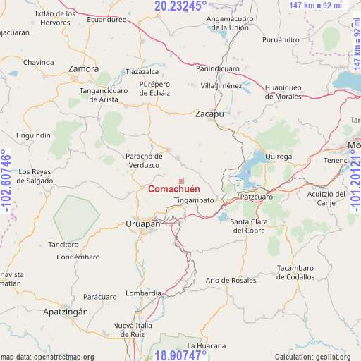
Comachuén GPS coordinates[2]
19° 34' 16.752" North, 101° 54' 15.588" West
| Map corner | latitude | longitude |
|---|---|---|
| Upper-left | 20.23245°, | -102.60746° |
| Center: | 19.57132°, | -101.90433° |
| Lower-right: | 18.90747°, | -101.20121° |
| Map W x H: | 147.3×147.3 km | = 91.5×91.5mi |
| max Lat: | 32.7° ⇑52.6% North |
| Comachuén: | 19.57132° |
| min Lat: | ⇓47.4% South 14.53588° |
| min Long | Comachuén | max Long |
| -117.105° | -101.90433° | -86.73105° |
| W 19.7%⇐ | ⇒80.3% E |
Elevation
Elevation of Comachuén is 2616 m = 8583 ft, and this is 1362.3 m = 4469 ft above average elevation for this country.
| Max E: |
3497 m = 11473 ft | 4.3% |
| Comachuén | 2616 m 8583 ft | |
| Avg. | 1253.7 m = 4113 ft | |
Min E: |
-1 m = -3 ft | 95.7% |
See also: Mexico elevation on elevation.city.
Geographical zone
Comachuén is located in North Torrid zone (between Equator and Tropic of Cancer). Distance of this Northern Tropic circle is 429.8 km =267.1 mi to North.| Distance of | km | miles | from Comachuén |
|---|---|---|---|
| North Pole | 7830.9 | 4865.9 | to North |
| Arctic Circle | 5225 | 3246.7 | to North |
| Tropic Cancer | 429.8 | 267.1 | to North |
| Equator | 2176.1 | 1352.2 | to South |


Nearby cities:
15 places around Comachuén: (largest is in red/bold)
• Arantepacua
7.3 km =4.5 mi,  292°
292°
• Aranza
16.2 km =10.1 mi,  309°
309°
• Capácuaro
15.7 km =9.8 mi,  260°
260°
• Caracha
15.3 km =9.5 mi,  186°
186°
• Cherán
13.7 km =8.5 mi,  337°
337°
• La Escondida
12.6 km =7.8 mi,  154°
154°
• Nahuatzén
9.4 km =5.8 mi,  351°
351°
• Pichátaro
10.2 km =6.3 mi,  89°
89°
• Quinceo
10.3 km =6.4 mi,  284°
284°
• San Andrés Coru
12.4 km =7.7 mi,  200°
200°
• San Isidro
11.2 km =7 mi,  44°
44°
• Santa María Huiramangaro (San Juan Tumbio)
15.9 km =9.9 mi,  113°
113°
• Sevina
6.4 km =4 mi,  3°
3°
• Tingambato
9.5 km =5.9 mi, 145°
• Turícuaro
3.5 km =2.2 mi,  269°
269°
Sources, notices
• [Note1] Compared only with cities in Mexico existing in our database
• [Src1] Map data: © OpenStreetMap contributors (CC-BY-SA)
• [Src2] Other city data from geonames.org with taken over terms of usage.
• [Src3] Geographical zone / Annual Mean Temperature by Robert A. Rohde @ Wikipedia
