Baviácora geodata
Baviácora (Sonora) is a seat of a second-order administrative division; located in Mexico in America/Hermosillo (GMT-7) time zone. With population of 1,890 people, there are 4603 cities with bigger population in this country. Compared to other cities in Mexico, 98.4% of cities are located further ↓South; 98.3% of cities are located further →East and 67.4% of cities have higher elevation than Baviácora. Note1


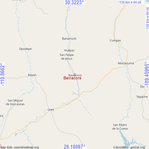
Baviácora GPS coordinates[2]
29° 42' 48.564" North, 110° 9' 47.052" West
| Map corner | latitude | longitude |
|---|---|---|
| Upper-left | 30.3223°, | -110.8662° |
| Center: | 29.71349°, | -110.16307° |
| Lower-right: | 29.10097°, | -109.45995° |
| Map W x H: | 135.8×135.8 km | = 84.4×84.4mi |
| max Lat: | 32.7° ⇑1.6% North |
| Baviácora: | 29.71349° |
| min Lat: | ⇓98.4% South 14.53588° |
| min Long | Baviácora | max Long |
| -117.105° | -110.16307° | -86.73105° |
| W 1.7%⇐ | ⇒98.3% E |
Elevation
Elevation of Baviácora is 560 m = 1837 ft, and this is 693.7 m = 2276 ft below average elevation for this country.
| Max E: |
3497 m = 11473 ft | 67.4% |
| Avg. | 1253.7 m = 4113 ft | |
| Baviácora | 560 m = 1837 ft | |
Min E: |
-1 m = -3 ft | 32.6% |
See also: Mexico elevation on elevation.city.
Geographical zone
Baviácora is located in North temperate zone (between Tropic of Cancer and the Arctic Circle). Distance of this Northern Tropic circle is 697.9 km =433.7 mi to South.| Distance of | km | miles | from Baviácora |
|---|---|---|---|
| North Pole | 6703.2 | 4165.2 | to North |
| Arctic Circle | 4097.3 | 2545.9 | to North |
| Tropic Cancer | 697.9 | 433.7 | to South |
| Equator | 3303.8 | 2052.9 | to South |


Nearby cities:
15 places around Baviácora: (largest is in red/bold)
• Aconchi
13.9 km =8.6 mi,  334°
334°
• Banámichi
33.1 km =20.6 mi,  351°
351°
• Cumpas
48.4 km =30.1 mi,  49°
49°
• Guadalupe
45.9 km =28.5 mi,  217°
217°
• Huépac
22.5 km =14 mi, 347°
• Jécori
48.1 km =29.9 mi,  58°
58°
• La Estancia
10 km =6.2 mi, 333°
• Los Hoyos
58.6 km =36.4 mi,  38°
38°
• Moctezuma
47.8 km =29.7 mi,  77°
77°
• Ojo de Agua
50.6 km =31.4 mi, 45°
• Opodepe
50.8 km =31.6 mi,  297°
297°
• Pueblo de Álamos
56.4 km =35 mi,  177°
177°
• Rayón
39.1 km =24.3 mi,  269°
269°
• San Felipe de Jesús
18 km =11.2 mi,  336°
336°
• Ures
38.5 km =23.9 mi,  214°
214°
Sources, notices
• [Note1] Compared only with cities in Mexico existing in our database
• [Src1] Map data: © OpenStreetMap contributors (CC-BY-SA)
• [Src2] Other city data from geonames.org with taken over terms of usage.
• [Src3] Geographical zone / Annual Mean Temperature by Robert A. Rohde @ Wikipedia
