2da. Sección de Medio Monte geodata
2da. Sección de Medio Monte (Chiapas) is a populated place; located in Mexico in America/Mexico_City (GMT-6) time zone. With population of 4,182 people, there are 2191 cities with bigger population in this country. Compared to other cities in Mexico, 99.7% of cities are located further ↑North; 94.3% of cities are located further ←West and 76% of cities have higher elevation than 2da. Sección de Medio Monte. Note1
Current local time in 2da. Sección de Medio Monte:
12:53 AM, WednesdayDifference from your time zone: hours


2da. Sección de Medio Monte GPS coordinates[2]
14° 52' 54.984" North, 92° 11' 3.984" West
| Map corner | latitude | longitude |
|---|---|---|
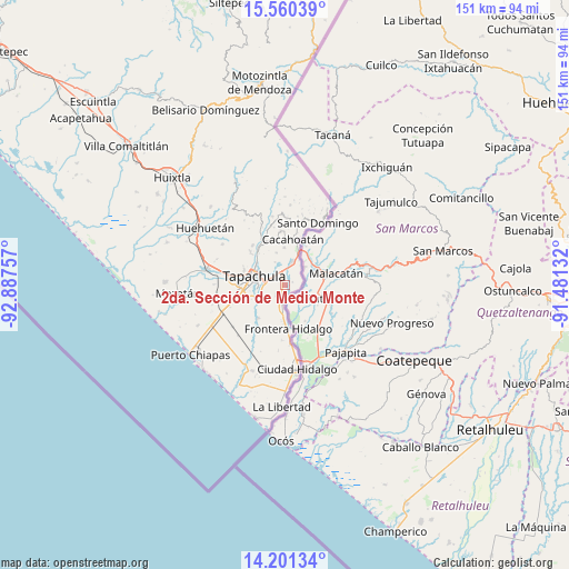
| Upper-left | 15.56039°, | -92.88757° |
| Center: | 14.88194°, | -92.18444° |
| Lower-right: | 14.20134°, | -91.48132° |
| Map W x H: | 151.1×151.1 km | = 93.9×93.9mi |
| max Lat: | 32.7° ⇑99.7% North |
| 2da. Sección de Medio Monte: | 14.88194° |
| min Lat: | ⇓0.3% South 14.53588° |
| min Long | 2da. Sección d | max Long |
| -117.105° | -92.18444° | -86.73105° |
| W 94.3%⇐ | ⇒5.7% E |
Elevation
Elevation of 2da. Sección de Medio Monte is 187 m = 614 ft, and this is 1066.7 m = 3500 ft below average elevation for this country.
| Max E: |
3497 m = 11473 ft | 76% |
| Avg. | 1253.7 m = 4113 ft | |
| 2da. Sección de Medio Monte | 187 m = 614 ft | |
Min E: |
-1 m = -3 ft | 24% |
See also: Mexico elevation on elevation.city.
Geographical zone
2da. Sección de Medio Monte is located in North Torrid zone (between Equator and Tropic of Cancer). Distance of this Northern Tropic circle is 951.2 km =591 mi to North.| Distance of | km | miles | from 2da. Sección de Medio Monte |
|---|---|---|---|
| North Pole | 8352.3 | 5189.9 | to North |
| Arctic Circle | 5746.5 | 3570.7 | to North |
| Tropic Cancer | 951.2 | 591 | to North |
| Equator | 1654.7 | 1028.2 | to South |


Nearby cities:
15 places around 2da. Sección de Medio Monte: (largest is in red/bold)
• 1ra. Sección de Izapa
4.6 km =2.9 mi,  18°
18°
• Cacahoatales
8.7 km =5.4 mi,  193°
193°
• El Arenal
8 km =5 mi,  182°
182°
• El Sacrificio
4.8 km =3 mi,  257°
257°
• La Joya
8 km =5 mi, 255°
• Los Encinos
5.7 km =3.5 mi,  271°
271°
• Los Hules
3.6 km =2.2 mi, 190°
• Los Palacios
8.4 km =5.2 mi,  250°
250°
• Metapa
5.1 km =3.2 mi, 188°
• Miguel Hidalgo
6.7 km =4.2 mi,  335°
335°
• Omoa
7.5 km =4.7 mi,  223°
223°
• Silvano Gatica
8.9 km =5.5 mi,  345°
345°
• Tapachula
8.2 km =5.1 mi,  287°
287°
• Tuxtla Chico
6.7 km =4.2 mi, 16°
• Vicente Guerrero
3.7 km =2.3 mi, 219°
Sources, notices
• [Note1] Compared only with cities in Mexico existing in our database
• [Src1] Map data: © OpenStreetMap contributors (CC-BY-SA)
• [Src2] Other city data from geonames.org with taken over terms of usage.
• [Src3] Geographical zone / Annual Mean Temperature by Robert A. Rohde @ Wikipedia
