Los Hules geodata
Los Hules (Chiapas) is a populated place; located in Mexico in America/Mexico_City (GMT-6) time zone. With population of 503 people, there are 16722 cities with bigger population in this country. Compared to other cities in Mexico, 99.8% of cities are located further ↑North; 94.2% of cities are located further ←West and 77.8% of cities have higher elevation than Los Hules. Note1


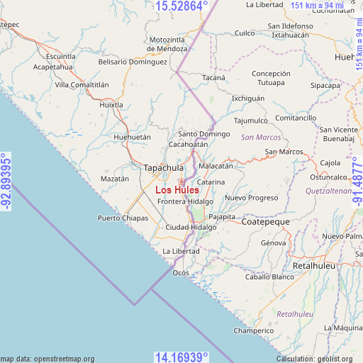
Los Hules GPS coordinates[2]
14° 51' 0.288" North, 92° 11' 26.952" West
| Map corner | latitude | longitude |
|---|---|---|
| Upper-left | 15.52864°, | -92.89395° |
| Center: | 14.85008°, | -92.19082° |
| Lower-right: | 14.16939°, | -91.4877° |
| Map W x H: | 151.1×151.1 km | = 93.9×93.9mi |
| max Lat: | 32.7° ⇑99.8% North |
| Los Hules: | 14.85008° |
| min Lat: | ⇓0.2% South 14.53588° |
| min Long | Los Hules | max Long |
| -117.105° | -92.19082° | -86.73105° |
| W 94.2%⇐ | ⇒5.8% E |
Elevation
Elevation of Los Hules is 136 m = 446 ft, and this is 1117.7 m = 3667 ft below average elevation for this country.
| Max E: |
3497 m = 11473 ft | 77.8% |
| Avg. | 1253.7 m = 4113 ft | |
| Los Hules | 136 m = 446 ft | |
Min E: |
-1 m = -3 ft | 22.2% |
See also: Mexico elevation on elevation.city.
Geographical zone
Los Hules is located in North Torrid zone (between Equator and Tropic of Cancer). Distance of this Northern Tropic circle is 954.7 km =593.2 mi to North.| Distance of | km | miles | from Los Hules |
|---|---|---|---|
| North Pole | 8355.9 | 5192.1 | to North |
| Arctic Circle | 5750 | 3572.9 | to North |
| Tropic Cancer | 954.7 | 593.2 | to North |
| Equator | 1651.2 | 1026 | to South |


Nearby cities:
15 places around Los Hules: (largest is in red/bold)
• 1ra. Sección de Izapa
8.2 km =5.1 mi,  15°
15°
• 2da. Sección de Medio Monte
3.6 km =2.2 mi,  10°
10°
• Cacahoatales
5.1 km =3.2 mi,  195°
195°
• El Arenal
4.5 km =2.8 mi,  175°
175°
• El Sacrificio
4.7 km =2.9 mi,  302°
302°
• Frontera Hidalgo
8.2 km =5.1 mi,  169°
169°
• Guadalupe Victoria
8.3 km =5.2 mi,  231°
231°
• La Joya
7.2 km =4.5 mi,  282°
282°
• Los Encinos
6.3 km =3.9 mi,  306°
306°
• Los Palacios
7.3 km =4.5 mi, 276°
• Metapa
1.5 km =0.9 mi, 184°
• Octavio Paz
7.9 km =4.9 mi, 276°
• Omoa
4.9 km =3 mi,  247°
247°
• Texcaltic
6.1 km =3.8 mi, 176°
• Vicente Guerrero
1.8 km =1.1 mi,  293°
293°
Sources, notices
• [Note1] Compared only with cities in Mexico existing in our database
• [Src1] Map data: © OpenStreetMap contributors (CC-BY-SA)
• [Src2] Other city data from geonames.org with taken over terms of usage.
• [Src3] Geographical zone / Annual Mean Temperature by Robert A. Rohde @ Wikipedia
