Santa Rita geodata
Santa Rita (Zacatecas) is a populated place; located in Mexico in America/Mexico_City (GMT-6) time zone. With population of 1,320 people, there are 6574 cities with bigger population in this country. Compared to other cities in Mexico, 87.8% of cities are located further ↓South; 83.6% of cities are located further →East and 77.8% of cities have lower elevation than Santa Rita. Note1


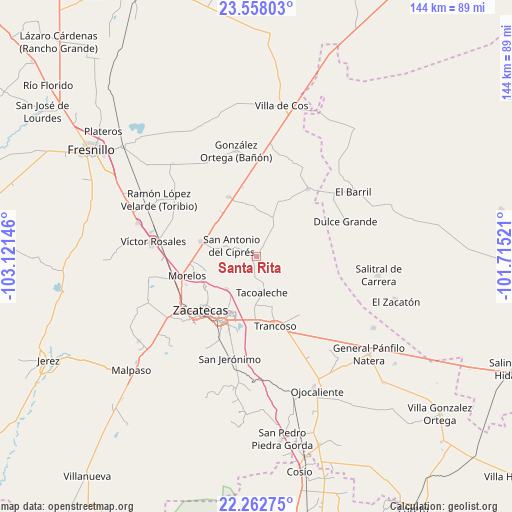
Santa Rita GPS coordinates[2]
22° 54' 42.984" North, 102° 25' 5.988" West
| Map corner | latitude | longitude |
|---|---|---|
| Upper-left | 23.55803°, | -103.12146° |
| Center: | 22.91194°, | -102.41833° |
| Lower-right: | 22.26275°, | -101.71521° |
| Map W x H: | 144×144 km | = 89.5×89.5mi |
| max Lat: | 32.7° ⇑12.2% North |
| Santa Rita: | 22.91194° |
| min Lat: | ⇓87.8% South 14.53588° |
| min Long | Santa Rita | max Long |
| -117.105° | -102.41833° | -86.73105° |
| W 16.4%⇐ | ⇒83.6% E |
Elevation
Elevation of Santa Rita is 2084 m = 6837 ft, and this is 830.3 m = 2724 ft above average elevation for this country.
| Max E: |
3497 m = 11473 ft | 22.2% |
| Santa Rita | 2084 m 6837 ft | |
| Avg. | 1253.7 m = 4113 ft | |
Min E: |
-1 m = -3 ft | 77.8% |
See also: Mexico elevation on elevation.city.
Geographical zone
Santa Rita is located in North Torrid zone (between Equator and Tropic of Cancer). Distance of this Northern Tropic circle is 58.4 km =36.3 mi to North.| Distance of | km | miles | from Santa Rita |
|---|---|---|---|
| North Pole | 7459.5 | 4635.1 | to North |
| Arctic Circle | 4853.6 | 3015.9 | to North |
| Tropic Cancer | 58.4 | 36.3 | to North |
| Equator | 2547.6 | 1583 | to South |


Nearby cities:
15 places around Santa Rita: (largest is in red/bold)
• Casa Blanca
11.8 km =7.3 mi,  104°
104°
• Casa de Cerros
11 km =6.8 mi,  254°
254°
• El Lampotal
1.8 km =1.1 mi,  183°
183°
• La Blanquita
14.3 km =8.9 mi,  163°
163°
• La Luz
11.6 km =7.2 mi,  107°
107°
• Los Pozos
12.1 km =7.5 mi,  322°
322°
• Pozos de Gamboa
16.1 km =10 mi,  284°
284°
• Pánuco
13.2 km =8.2 mi, 252°
• San Antonio del Cipres
7.6 km =4.7 mi,  292°
292°
• San José de la Era
6.8 km =4.2 mi, 183°
• San Juan
11.9 km =7.4 mi,  18°
18°
• Sauceda de La Borda
12.5 km =7.8 mi,  223°
223°
• Tacoaleche
10.3 km =6.4 mi,  172°
172°
• Vetagrande
16.6 km =10.3 mi,  238°
238°
• Zoquite
14.1 km =8.8 mi, 181°
Sources, notices
• [Note1] Compared only with cities in Mexico existing in our database
• [Src1] Map data: © OpenStreetMap contributors (CC-BY-SA)
• [Src2] Other city data from geonames.org with taken over terms of usage.
• [Src3] Geographical zone / Annual Mean Temperature by Robert A. Rohde @ Wikipedia
