Las Fincas geodata
Las Fincas (Quintana Roo) is a populated place; located in Mexico in America/Cancun (GMT-5) time zone. With population of 746 people, there are 11739 cities with bigger population in this country. Compared to other cities in Mexico, 67.7% of cities are located further ↓South; 100% of cities are located further ←West and 98.1% of cities have higher elevation than Las Fincas. Note1


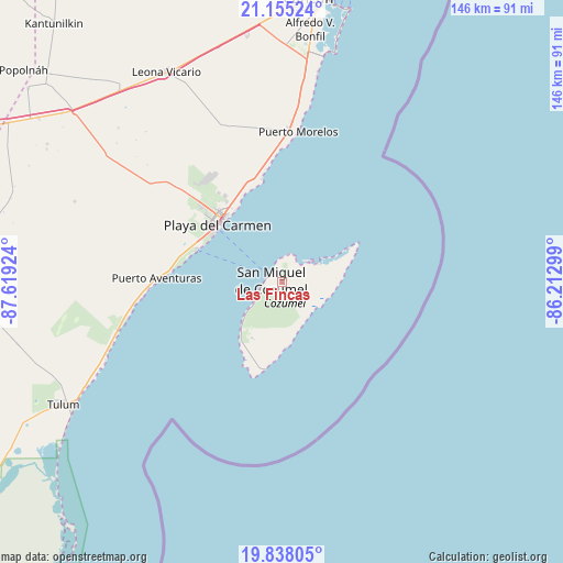
Las Fincas GPS coordinates[2]
20° 29' 53.016" North, 86° 54' 57.996" West
| Map corner | latitude | longitude |
|---|---|---|
| Upper-left | 21.15524°, | -87.61924° |
| Center: | 20.49806°, | -86.91611° |
| Lower-right: | 19.83805°, | -86.21299° |
| Map W x H: | 146.5×146.5 km | = 91×91mi |
| max Lat: | 32.7° ⇑32.3% North |
| Las Fincas: | 20.49806° |
| min Lat: | ⇓67.7% South 14.53588° |
| min Long | Las Fincas | max Long |
| -117.105° | -86.91611° | -86.73105° |
| W 100%⇐ | ⇒0% E |
Elevation
Elevation of Las Fincas is 8 m = 26 ft, and this is 1245.7 m = 4087 ft below average elevation for this country.
| Max E: |
3497 m = 11473 ft | 98.1% |
| Avg. | 1253.7 m = 4113 ft | |
| Las Fincas | 8 m = 26 ft | |
Min E: |
-1 m = -3 ft | 1.9% |
See also: Mexico elevation on elevation.city.
Geographical zone
Las Fincas is located in North Torrid zone (between Equator and Tropic of Cancer). Distance of this Northern Tropic circle is 326.7 km =203 mi to North.| Distance of | km | miles | from Las Fincas |
|---|---|---|---|
| North Pole | 7727.9 | 4801.9 | to North |
| Arctic Circle | 5122 | 3182.7 | to North |
| Tropic Cancer | 326.7 | 203 | to North |
| Equator | 2279.2 | 1416.2 | to South |


Nearby cities:
15 places around Las Fincas: (largest is in red/bold)
• Akumal
43 km =26.7 mi,  254°
254°
• Alfredo V. Bonfil
66 km =41 mi,  6°
6°
• Barceló Maya
34.4 km =21.4 mi,  268°
268°
• Cancún
75.5 km =46.9 mi, 5°
• Ciudad Chemuyil
48.5 km =30.1 mi, 249°
• Cozumel
2.8 km =1.7 mi,  275°
275°
• El Porvenir
65.1 km =40.5 mi,  352°
352°
• El Tintal
72 km =44.7 mi,  307°
307°
• Francisco Uh May
71.8 km =44.6 mi,  258°
258°
• Leona Vicario
62.2 km =38.6 mi,  331°
331°
• Macario Gómez
70.6 km =43.9 mi, 256°
• Playa del Carmen
22.3 km =13.9 mi, 310°
• Puerto Aventuras
32.3 km =20.1 mi, 270°
• San Francisco
70.9 km =44.1 mi,  300°
300°
• Tulum
65.3 km =40.6 mi,  240°
240°
Sources, notices
• [Note1] Compared only with cities in Mexico existing in our database
• [Src1] Map data: © OpenStreetMap contributors (CC-BY-SA)
• [Src2] Other city data from geonames.org with taken over terms of usage.
• [Src3] Geographical zone / Annual Mean Temperature by Robert A. Rohde @ Wikipedia
