Maxmadi geodata
Maxmadi (Guerrero) is a populated place; located in Mexico in America/Mexico_City (GMT-6) time zone. With population of 607 people, there are 14186 cities with bigger population in this country. Compared to other cities in Mexico, 92.1% of cities are located further ↑North; 56.2% of cities are located further ←West and 71.7% of cities have higher elevation than Maxmadi. Note1


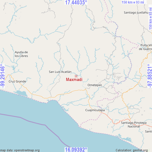
Maxmadi GPS coordinates[2]
16° 46' 5.988" North, 98° 35' 17.988" West
| Map corner | latitude | longitude |
|---|---|---|
| Upper-left | 17.44035°, | -99.29146° |
| Center: | 16.76833°, | -98.58833° |
| Lower-right: | 16.09392°, | -97.88521° |
| Map W x H: | 149.7×149.7 km | = 93×93mi |
| max Lat: | 32.7° ⇑92.1% North |
| Maxmadi: | 16.76833° |
| min Lat: | ⇓7.9% South 14.53588° |
| min Long | Maxmadi | max Long |
| -117.105° | -98.58833° | -86.73105° |
| W 56.2%⇐ | ⇒43.8% E |
Elevation
Elevation of Maxmadi is 338 m = 1109 ft, and this is 915.7 m = 3004 ft below average elevation for this country.
| Max E: |
3497 m = 11473 ft | 71.7% |
| Avg. | 1253.7 m = 4113 ft | |
| Maxmadi | 338 m = 1109 ft | |
Min E: |
-1 m = -3 ft | 28.3% |
See also: Mexico elevation on elevation.city.
Geographical zone
Maxmadi is located in North Torrid zone (between Equator and Tropic of Cancer). Distance of this Northern Tropic circle is 741.5 km =460.7 mi to North.| Distance of | km | miles | from Maxmadi |
|---|---|---|---|
| North Pole | 8142.6 | 5059.6 | to North |
| Arctic Circle | 5536.7 | 3440.3 | to North |
| Tropic Cancer | 741.5 | 460.7 | to North |
| Equator | 1864.5 | 1158.5 | to South |


Nearby cities:
15 places around Maxmadi: (largest is in red/bold)
• Acalmani
10.2 km =6.3 mi,  58°
58°
• Arcelia de Rodríguez
7 km =4.3 mi,  239°
239°
• Arroyo Cumiapa
12.2 km =7.6 mi,  346°
346°
• Azoyú
4.2 km =2.6 mi,  199°
199°
• Chacalapa
14.5 km =9 mi,  72°
72°
• Cuanacaxtitlán
6.5 km =4 mi,  302°
302°
• Huehuetán
15.1 km =9.4 mi,  167°
167°
• Igualapa
12.2 km =7.6 mi,  101°
101°
• Jolotichán
15.2 km =9.4 mi,  263°
263°
• Quetzalapa
9.3 km =5.8 mi,  78°
78°
• San Isidro el Puente (El Puente)
13.3 km =8.3 mi, 198°
• San José Buenavista
13.5 km =8.4 mi,  46°
46°
• Tenango
12.8 km =8 mi,  152°
152°
• Yoloxóchitl
11.7 km =7.3 mi, 296°
• Zapotitlán de la Fuente (El Zapote)
5.7 km =3.5 mi,  219°
219°
Sources, notices
• [Note1] Compared only with cities in Mexico existing in our database
• [Src1] Map data: © OpenStreetMap contributors (CC-BY-SA)
• [Src2] Other city data from geonames.org with taken over terms of usage.
• [Src3] Geographical zone / Annual Mean Temperature by Robert A. Rohde @ Wikipedia
