Guadalupe Nuevo Centro geodata
Guadalupe Nuevo Centro (Oaxaca) is a populated place; located in Mexico in America/Mexico_City (GMT-6) time zone. With population of 532 people, there are 15923 cities with bigger population in this country. Compared to other cities in Mexico, 91.8% of cities are located further ↑North; 64.8% of cities are located further ←West and 55.7% of cities have higher elevation than Guadalupe Nuevo Centro. Note1


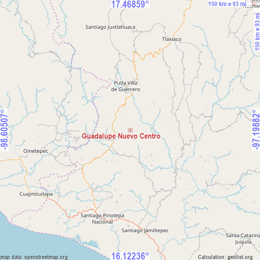
Guadalupe Nuevo Centro GPS coordinates[2]
16° 47' 48.012" North, 97° 54' 6.984" West
| Map corner | latitude | longitude |
|---|---|---|
| Upper-left | 17.46859°, | -98.60507° |
| Center: | 16.79667°, | -97.90194° |
| Lower-right: | 16.12236°, | -97.19882° |
| Map W x H: | 149.7×149.7 km | = 93×93mi |
| max Lat: | 32.7° ⇑91.8% North |
| Guadalupe Nuevo Centro: | 16.79667° |
| min Lat: | ⇓8.2% South 14.53588° |
| min Long | Guadalupe Nuevo | max Long |
| -117.105° | -97.90194° | -86.73105° |
| W 64.8%⇐ | ⇒35.2% E |
Elevation
Elevation of Guadalupe Nuevo Centro is 1173 m = 3848 ft, and this is 80.7 m = 265 ft below average elevation for this country.
| Max E: |
3497 m = 11473 ft | 55.7% |
| Avg. | 1253.7 m = 4113 ft | |
| Guadalupe Nuevo Centro | 1173 m = 3848 ft | |
Min E: |
-1 m = -3 ft | 44.3% |
See also: Mexico elevation on elevation.city.
Geographical zone
Guadalupe Nuevo Centro is located in North Torrid zone (between Equator and Tropic of Cancer). Distance of this Northern Tropic circle is 738.3 km =458.8 mi to North.| Distance of | km | miles | from Guadalupe Nuevo Centro |
|---|---|---|---|
| North Pole | 8139.4 | 5057.6 | to North |
| Arctic Circle | 5533.6 | 3438.4 | to North |
| Tropic Cancer | 738.3 | 458.8 | to North |
| Equator | 1867.6 | 1160.5 | to South |


Nearby cities:
15 places around Guadalupe Nuevo Centro: (largest is in red/bold)
• Aquiles Serdán
10.6 km =6.6 mi,  301°
301°
• Asunción Atoyaquillo
12.7 km =7.9 mi,  85°
85°
• Concepción las Mesas
11.2 km =7 mi,  326°
326°
• El Rosario
11 km =6.8 mi,  312°
312°
• El Tapanco
10.1 km =6.3 mi,  281°
281°
• Hidalgo
20.2 km =12.6 mi,  82°
82°
• La Reforma
20.1 km =12.5 mi,  162°
162°
• San José de las Flores
20.1 km =12.5 mi, 310°
• San Juan Cabeza del Río
5.3 km =3.3 mi, 156°
• San Miguel Reyes
13.9 km =8.6 mi,  3°
3°
• San Vicente Piñas
16.9 km =10.5 mi,  265°
265°
• Santa Cruz Tutiahua
3.3 km =2.1 mi,  197°
197°
• Santa María Zacatepec
10.1 km =6.3 mi,  248°
248°
• Zaragoza
18.3 km =11.4 mi,  140°
140°
• Zimatlán
17.4 km =10.8 mi,  25°
25°
Sources, notices
• [Note1] Compared only with cities in Mexico existing in our database
• [Src1] Map data: © OpenStreetMap contributors (CC-BY-SA)
• [Src2] Other city data from geonames.org with taken over terms of usage.
• [Src3] Geographical zone / Annual Mean Temperature by Robert A. Rohde @ Wikipedia
