San José Tipceh geodata
San José Tipceh (Yucatán) is a populated place; located in Mexico in America/Merida (GMT-6) time zone. With population of 513 people, there are 16399 cities with bigger population in this country. Compared to other cities in Mexico, 67% of cities are located further ↓South; 97.8% of cities are located further ←West and 89.7% of cities have higher elevation than San José Tipceh. Note1


San José Tipceh GPS coordinates[2]
20° 27' 42.012" North, 89° 40' 13.008" West
| Map corner | latitude | longitude |
|---|---|---|
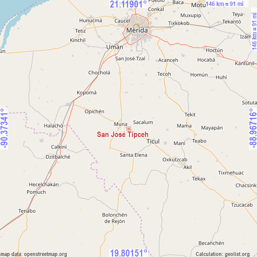
| Upper-left | 21.11901°, | -90.37341° |
| Center: | 20.46167°, | -89.67028° |
| Lower-right: | 19.80151°, | -88.96716° |
| Map W x H: | 146.5×146.5 km | = 91×91mi |
| max Lat: | 32.7° ⇑33% North |
| San José Tipceh: | 20.46167° |
| min Lat: | ⇓67% South 14.53588° |
| min Long | San José Tipce | max Long |
| -117.105° | -89.67028° | -86.73105° |
| W 97.8%⇐ | ⇒2.2% E |
Elevation
Elevation of San José Tipceh is 25 m = 82 ft, and this is 1228.7 m = 4031 ft below average elevation for this country.
| Max E: |
3497 m = 11473 ft | 89.7% |
| Avg. | 1253.7 m = 4113 ft | |
| San José Tipceh | 25 m = 82 ft | |
Min E: |
-1 m = -3 ft | 10.3% |
See also: Mexico elevation on elevation.city.
Geographical zone
San José Tipceh is located in North Torrid zone (between Equator and Tropic of Cancer). Distance of this Northern Tropic circle is 330.8 km =205.5 mi to North.| Distance of | km | miles | from San José Tipceh |
|---|---|---|---|
| North Pole | 7731.9 | 4804.4 | to North |
| Arctic Circle | 5126 | 3185.1 | to North |
| Tropic Cancer | 330.8 | 205.5 | to North |
| Equator | 2275.1 | 1413.7 | to South |


Nearby cities:
15 places around San José Tipceh: (largest is in red/bold)
• Abala
20.7 km =12.9 mi,  356°
356°
• Calcehtoc
27.9 km =17.3 mi,  295°
295°
• Chapab
22.2 km =13.8 mi,  90°
90°
• Citincabchen
15.3 km =9.5 mi,  65°
65°
• Dzan
22.5 km =14 mi,  111°
111°
• Muna
5.4 km =3.4 mi, 302°
• Opichen
21.9 km =13.6 mi, 297°
• Pustunich
19.5 km =12.1 mi,  121°
121°
• Sacalum
9.2 km =5.7 mi,  64°
64°
• Santa Elena
15 km =9.3 mi,  169°
169°
• Telchaquillo
29.8 km =18.5 mi,  46°
46°
• Temozon Sur
25.1 km =15.6 mi,  4°
4°
• Ticul
15.7 km =9.8 mi, 116°
• Uayalceh de Peón
26.9 km =16.7 mi,  16°
16°
• Yotholin
27 km =16.8 mi, 123°
Sources, notices
• [Note1] Compared only with cities in Mexico existing in our database
• [Src1] Map data: © OpenStreetMap contributors (CC-BY-SA)
• [Src2] Other city data from geonames.org with taken over terms of usage.
• [Src3] Geographical zone / Annual Mean Temperature by Robert A. Rohde @ Wikipedia
