Kampung Tekek geodata
Kampung Tekek (Pahang) is a populated place; located in Malaysia in Asia/Kuala_Lumpur (GMT+8) time zone. With population of 2,000 people, there are 168 cities with bigger population in this country. Compared to other cities in Malaysia, 69.7% of cities are located further ↑North; 81.5% of cities are located further ←West and 50.6% of cities have lower elevation than Kampung Tekek. Note1


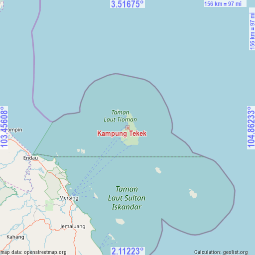
Kampung Tekek GPS coordinates[2]
2° 48' 52.92" North, 104° 9' 33.12" East
| Map corner | latitude | longitude |
|---|---|---|
| Upper-left | 3.51675°, | 103.45608° |
| Center: | 2.8147°, | 104.1592° |
| Lower-right: | 2.11223°, | 104.86233° |
| Map W x H: | 156.2×156.2 km | = 97.1×97.1mi |
| max Lat: | 6.88732° ⇑69.7% North |
| Kampung Tekek: | 2.8147° |
| min Lat: | ⇓30.3% South 1.24722° |
| min Long | Kampung Tekek | max Long |
| 99.68252° | 104.1592° | 118.61119° |
| W 81.5%⇐ | ⇒18.5% E |
Elevation
Elevation of Kampung Tekek is 14 m = 46 ft, and this is 30.7 m = 101 ft below average elevation for this country.
| Max E: |
1488 m = 4882 ft | 49.4% |
| Avg. | 44.7 m = 147 ft | |
| Kampung Tekek | 14 m = 46 ft | |
Min E: |
0 m = 0 ft | 50.6% |
See also: Malaysia elevation on elevation.city.
Geographical zone
Kampung Tekek is located in North Torrid zone (between Equator and Tropic of Cancer). Distance of Equator is 313 km =194.5 mi to South.| Distance of | km | miles | from Kampung Tekek |
|---|---|---|---|
| North Pole | 9694.1 | 6023.6 | to North |
| Arctic Circle | 7088.2 | 4404.4 | to North |
| Tropic Cancer | 2293 | 1424.8 | to North |
| Equator | 313 | 194.5 | to South |


Nearby cities:
15 places around Kampung Tekek: (largest is in red/bold)
• Chaah
138.5 km =86.1 mi,  242°
242°
• Kampung Pasir Gudang Baru
152.5 km =94.8 mi,  191°
191°
• Kampung Simpang Renggam
145.4 km =90.3 mi,  221°
221°
• Kelapa Sawit
145.1 km =90.2 mi,  208°
208°
• Kluang
127.9 km =79.5 mi,  227°
227°
• Kota Tinggi
123.1 km =76.5 mi, 193°
• Kuantan
144 km =89.5 mi,  320°
320°
• Kulai
142.9 km =88.8 mi, 205°
• Labis
135.2 km =84 mi,  249°
249°
• Mersing
55.4 km =34.4 mi, 219°
• Pekan
112.4 km =69.8 mi,  311°
311°
• Skudai
152.6 km =94.8 mi,  201°
201°
• Taman Senai
146.7 km =91.2 mi, 203°
• Ulu Tiram
140.3 km =87.2 mi, 195°
• Yong Peng
150.6 km =93.6 mi, 233°
Sources, notices
• [Note1] Compared only with cities in Malaysia existing in our database
• [Src1] Map data: © OpenStreetMap contributors (CC-BY-SA)
• [Src2] Other city data from geonames.org with taken over terms of usage.
• [Src3] Geographical zone / Annual Mean Temperature by Robert A. Rohde @ Wikipedia
