Long Ampan Aing or Abanang geodata
Long Ampan Aing or Abanang (Sarawak) is a historical populated place; located in Malaysia in Asia/Kuching (GMT+8) time zone. With population of 1,850 people, there are 171 cities with bigger population in this country. Compared to other cities in Malaysia, 74.2% of cities are located further ↑North; 88.2% of cities are located further ←West and 98.9% of cities have lower elevation than Long Ampan Aing or Abanang. Note1
Current local time in Long Ampan Aing or Abanang:
06:00 PM, MondayDifference from your time zone: hours


Long Ampan Aing or Abanang GPS coordinates[2]
2° 39' 24.156" North, 114° 44' 12.3" East
| Map corner | latitude | longitude |
|---|---|---|
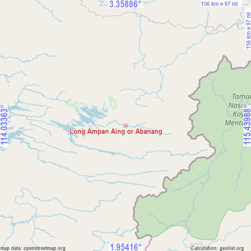
| Upper-left | 3.35886°, | 114.03363° |
| Center: | 2.65671°, | 114.73675° |
| Lower-right: | 1.95416°, | 115.43988° |
| Map W x H: | 156.2×156.2 km | = 97.1×97.1mi |
| max Lat: | 6.88732° ⇑74.2% North |
| Long Ampan Aing or Abanang: | 2.65671° |
| min Lat: | ⇓25.8% South 1.24722° |
| min Long | Long Ampan Aing | max Long |
| 99.68252° | 114.73675° | 118.61119° |
| W 88.2%⇐ | ⇒11.8% E |
Elevation
Elevation of Long Ampan Aing or Abanang is 705 m = 2313 ft, and this is 660.3 m = 2166 ft above average elevation for this country.
| Max E: |
1488 m = 4882 ft | 1.1% |
| Long Ampan Aing or Abanang | 705 m 2313 ft | |
| Avg. | 44.7 m = 147 ft | |
Min E: |
0 m = 0 ft | 98.9% |
See also: Malaysia elevation on elevation.city.
Geographical zone
Long Ampan Aing or Abanang is located in North Torrid zone (between Equator and Tropic of Cancer). Distance of Equator is 295.4 km =183.6 mi to South.| Distance of | km | miles | from Long Ampan Aing or Abanang |
|---|---|---|---|
| North Pole | 9711.7 | 6034.6 | to North |
| Arctic Circle | 7105.8 | 4415.3 | to North |
| Tropic Cancer | 2310.5 | 1435.7 | to North |
| Equator | 295.4 | 183.6 | to South |


Nearby cities:
15 places around Long Ampan Aing or Abanang: (largest is in red/bold)
• Bandar Labuan
298.6 km =185.5 mi,  11°
11°
• Batu Niah
167.8 km =104.3 mi,  319°
319°
• Beaufort
319.4 km =198.5 mi,  20°
20°
• Bintulu
197.5 km =122.7 mi,  286°
286°
• Data Kakus
123.8 km =76.9 mi,  269°
269°
• Kapit
213.5 km =132.7 mi,  249°
249°
• Keningau
337.3 km =209.6 mi,  27°
27°
• Labuan
297.2 km =184.7 mi, 10°
• Lawas
256.1 km =159.1 mi, 16°
• Lidung Jelo
5.6 km =3.5 mi,  99°
99°
• Limbang
234.6 km =145.8 mi, 7°
• Marudi
176 km =109.4 mi,  344°
344°
• Miri
210.7 km =130.9 mi, 336°
• Mukah
295 km =183.3 mi,  275°
275°
• Sibu
326.8 km =203.1 mi,  263°
263°
Sources, notices
• [Note1] Compared only with cities in Malaysia existing in our database
• [Src1] Map data: © OpenStreetMap contributors (CC-BY-SA)
• [Src2] Other city data from geonames.org with taken over terms of usage.
• [Src3] Geographical zone / Annual Mean Temperature by Robert A. Rohde @ Wikipedia
