Limbang geodata
Limbang (Sarawak) is a populated place; located in Malaysia in Asia/Kuching (GMT+8) time zone. With population of 26,199 people, there are 100 cities with bigger population in this country. Compared to other cities in Malaysia, 60.7% of cities are located further ↓South; 89.3% of cities are located further ←West and 88.8% of cities have higher elevation than Limbang. Note1


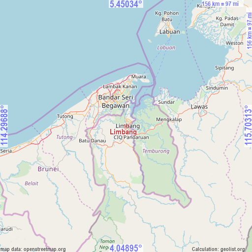
Limbang GPS coordinates[2]
4° 45' 0" North, 115° 0' 0" East
| Map corner | latitude | longitude |
|---|---|---|
| Upper-left | 5.45034°, | 114.29688° |
| Center: | 4.75°, | 115° |
| Lower-right: | 4.04895°, | 115.70313° |
| Map W x H: | 155.8×155.8 km | = 96.8×96.8mi |
| max Lat: | 6.88732° ⇑39.3% North |
| Limbang: | 4.75° |
| min Lat: | ⇓60.7% South 1.24722° |
| min Long | Limbang | max Long |
| 99.68252° | 115° | 118.61119° |
| W 89.3%⇐ | ⇒10.7% E |
Elevation
Elevation of Limbang is 6 m = 20 ft, and this is 38.7 m = 127 ft below average elevation for this country.
| Max E: |
1488 m = 4882 ft | 88.8% |
| Avg. | 44.7 m = 147 ft | |
| Limbang | 6 m = 20 ft | |
Min E: |
0 m = 0 ft | 11.2% |
See also: Malaysia elevation on elevation.city.
Geographical zone
Limbang is located in North Torrid zone (between Equator and Tropic of Cancer). Distance of Equator is 528.2 km =328.2 mi to South.| Distance of | km | miles | from Limbang |
|---|---|---|---|
| North Pole | 9478.9 | 5889.9 | to North |
| Arctic Circle | 6873 | 4270.7 | to North |
| Tropic Cancer | 2077.8 | 1291.1 | to North |
| Equator | 528.2 | 328.2 | to South |


Nearby cities:
15 places around Limbang: (largest is in red/bold)
• Bandar Labuan
66.9 km =41.6 mi,  26°
26°
• Batu Niah
174.3 km =108.3 mi,  232°
232°
• Beaufort
106 km =65.9 mi,  51°
51°
• Donggongon
177.3 km =110.2 mi,  43°
43°
• Keningau
144.2 km =89.6 mi,  63°
63°
• Kg Ramayah
174.8 km =108.6 mi, 43°
• Kinarut
166.3 km =103.3 mi, 44°
• Kota Kinabalu
180.7 km =112.3 mi, 41°
• Labuan
65 km =40.4 mi,  24°
24°
• Lawas
46.9 km =29.1 mi,  74°
74°
• Marudi
98.5 km =61.2 mi, 230°
• Miri
118.4 km =73.6 mi,  250°
250°
• Papar
150.4 km =93.5 mi, 43°
• Putatan
175.7 km =109.2 mi, 41°
• Ranau
227.7 km =141.5 mi, 53°
Sources, notices
• [Note1] Compared only with cities in Malaysia existing in our database
• [Src1] Map data: © OpenStreetMap contributors (CC-BY-SA)
• [Src2] Other city data from geonames.org with taken over terms of usage.
• [Src3] Geographical zone / Annual Mean Temperature by Robert A. Rohde @ Wikipedia
