Labuan geodata
Labuan is a seat of a first-order administrative division; located in Malaysia in Asia/Kuching (GMT+8) time zone. With population of 73,653 people, there are 45 cities with bigger population in this country. Compared to other cities in Malaysia, 66.9% of cities are located further ↓South; 89.9% of cities are located further ←West and 99.4% of cities have higher elevation than Labuan. Note1


Labuan GPS coordinates[2]
5° 16' 49.008" North, 115° 14' 51" East
| Map corner | latitude | longitude |
|---|---|---|
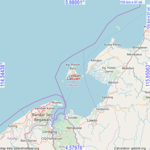
| Upper-left | 5.98001°, | 114.54438° |
| Center: | 5.28028°, | 115.2475° |
| Lower-right: | 4.57976°, | 115.95063° |
| Map W x H: | 155.7×155.7 km | = 96.7×96.7mi |
| max Lat: | 6.88732° ⇑33.1% North |
| Labuan: | 5.28028° |
| min Lat: | ⇓66.9% South 1.24722° |
| min Long | Labuan | max Long |
| 99.68252° | 115.2475° | 118.61119° |
| W 89.9%⇐ | ⇒10.1% E |
Elevation
Elevation of Labuan is 1 m = 3 ft, and this is 43.7 m = 143 ft below average elevation for this country.
| Max E: |
1488 m = 4882 ft | 99.4% |
| Avg. | 44.7 m = 147 ft | |
| Labuan | 1 m = 3 ft | |
Min E: |
0 m = 0 ft | 0.6% |
See also: Labuan elevation on elevation.city.
Geographical zone
Labuan is located in North Torrid zone (between Equator and Tropic of Cancer). Distance of Equator is 587.1 km =364.8 mi to South.| Distance of | km | miles | from Labuan |
|---|---|---|---|
| North Pole | 9419.9 | 5853.3 | to North |
| Arctic Circle | 6814.1 | 4234.1 | to North |
| Tropic Cancer | 2018.8 | 1254.4 | to North |
| Equator | 587.1 | 364.8 | to South |


Nearby cities:
15 places around Labuan: (largest is in red/bold)
• Bandar Labuan
2.6 km =1.6 mi,  68°
68°
• Beaufort
55.6 km =34.5 mi,  82°
82°
• Donggongon
117.4 km =72.9 mi,  53°
53°
• Keningau
101.2 km =62.9 mi,  86°
86°
• Kg Ramayah
115.2 km =71.6 mi, 54°
• Kinarut
107.1 km =66.5 mi,  55°
55°
• Kota Belud
176.9 km =109.9 mi, 47°
• Kota Kinabalu
119.6 km =74.3 mi, 49°
• Lawas
50 km =31.1 mi,  159°
159°
• Limbang
65 km =40.4 mi,  204°
204°
• Marudi
159.7 km =99.2 mi,  220°
220°
• Miri
170.2 km =105.8 mi,  234°
234°
• Papar
91.1 km =56.6 mi, 56°
• Putatan
115.1 km =71.5 mi, 51°
• Ranau
173.7 km =107.9 mi, 64°
Sources, notices
• [Note1] Compared only with cities in Malaysia existing in our database
• [Src1] Map data: © OpenStreetMap contributors (CC-BY-SA)
• [Src2] Other city data from geonames.org with taken over terms of usage.
• [Src3] Geographical zone / Annual Mean Temperature by Robert A. Rohde @ Wikipedia
