Sabon Garin Nangere geodata
Sabon Garin Nangere (Yobe) is a seat of a second-order administrative division; located in Nigeria in Africa/Lagos (GMT+1) time zone. In our database, there are 451 cities with bigger population. Compared to other cities in Nigeria, 82.4% of cities are located further ↓South; 89.3% of cities are located further ←West and 69.2% of cities have lower elevation than Sabon Garin Nangere. Note1


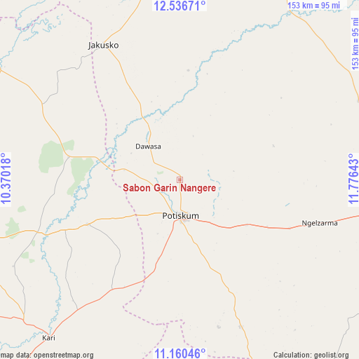
Sabon Garin Nangere GPS coordinates[2]
11° 50' 58.02" North, 11° 4' 23.88" East
| Map corner | latitude | longitude |
|---|---|---|
| Upper-left | 12.53671°, | 10.37018° |
| Center: | 11.84945°, | 11.0733° |
| Lower-right: | 11.16046°, | 11.77643° |
| Map W x H: | 153×153 km | = 95.1×95.1mi |
| max Lat: | 13.7543° ⇑17.6% North |
| Sabon Garin Nangere: | 11.84945° |
| min Lat: | ⇓82.4% South 4.31231° |
| min Long | Sabon Garin Nan | max Long |
| 2.73333° | 11.0733° | 14.46552° |
| W 89.3%⇐ | ⇒10.7% E |
Elevation
Elevation of Sabon Garin Nangere is 394 m = 1293 ft, and this is 97.5 m = 320 ft above average elevation for this country.
| Max E: |
1599 m = 5246 ft | 30.8% |
| Sabon Garin Nangere | 394 m 1293 ft | |
| Avg. | 296.5 m = 973 ft | |
Min E: |
2 m = 7 ft | 69.2% |
See also: Nigeria elevation on elevation.city.
Geographical zone
Sabon Garin Nangere is located in North Torrid zone (between Equator and Tropic of Cancer). Distance of this Northern Tropic circle is 1288.4 km =800.6 mi to North.| Distance of | km | miles | from Sabon Garin Nangere |
|---|---|---|---|
| North Pole | 8689.5 | 5399.4 | to North |
| Arctic Circle | 6083.6 | 3780.2 | to North |
| Tropic Cancer | 1288.4 | 800.6 | to North |
| Equator | 1317.5 | 818.7 | to South |


Nearby cities:
15 places around Sabon Garin Nangere: (largest is in red/bold)
• Babban Gida
83.1 km =51.6 mi,  65°
65°
• Damagum
34.3 km =21.3 mi,  123°
123°
• Dambam
44.1 km =27.4 mi,  244°
244°
• Dapchi
85.5 km =53.1 mi,  32°
32°
• Daura
48.9 km =30.4 mi,  132°
132°
• Fika
67.6 km =42 mi,  157°
157°
• Gamawa
66.3 km =41.2 mi,  298°
298°
• Jakusko
66.5 km =41.3 mi,  330°
330°
• Kari
87.2 km =54.2 mi,  219°
219°
• Lajere
42.5 km =26.4 mi, 69°
• Madara
68.5 km =42.6 mi,  263°
263°
• Nafada
88.4 km =54.9 mi, 161°
• Potiskum
15.1 km =9.4 mi,  176°
176°
• Sade
69.8 km =43.4 mi, 218°
• Yanda Bayo
52.2 km =32.4 mi, 223°
Sources, notices
• [Note1] Compared only with cities in Nigeria existing in our database
• [Src1] Map data: © OpenStreetMap contributors (CC-BY-SA)
• [Src2] Other city data from geonames.org with taken over terms of usage.
• [Src3] Geographical zone / Annual Mean Temperature by Robert A. Rohde @ Wikipedia
