Shelleng geodata
Shelleng (Adamawa) is a seat of a second-order administrative division; located in Nigeria in Africa/Lagos (GMT+1) time zone. In our database, there are 451 cities with bigger population. Compared to other cities in Nigeria, 63.3% of cities are located further ↓South; 93.7% of cities are located further ←West and 63.6% of cities have higher elevation than Shelleng. Note1


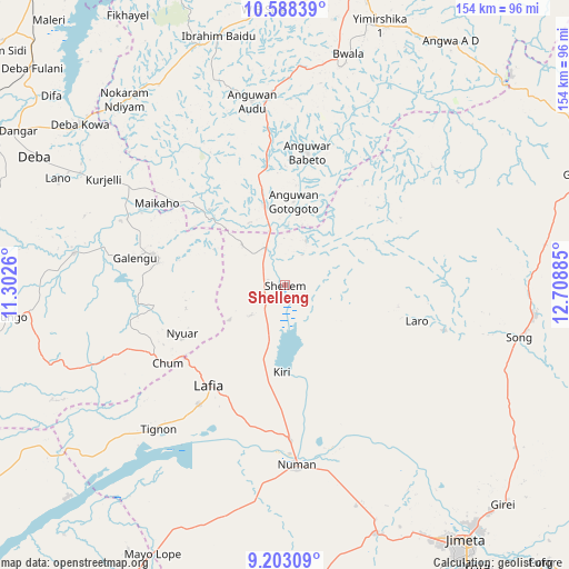
Shelleng GPS coordinates[2]
9° 53' 47.292" North, 12° 0' 20.592" East
| Map corner | latitude | longitude |
|---|---|---|
| Upper-left | 10.58839°, | 11.3026° |
| Center: | 9.89647°, | 12.00572° |
| Lower-right: | 9.20309°, | 12.70885° |
| Map W x H: | 154×154 km | = 95.7×95.7mi |
| max Lat: | 13.7543° ⇑36.7% North |
| Shelleng: | 9.89647° |
| min Lat: | ⇓63.3% South 4.31231° |
| min Long | Shelleng | max Long |
| 2.73333° | 12.00572° | 14.46552° |
| W 93.7%⇐ | ⇒6.3% E |
Elevation
Elevation of Shelleng is 185 m = 607 ft, and this is 111.5 m = 366 ft below average elevation for this country.
| Max E: |
1599 m = 5246 ft | 63.6% |
| Avg. | 296.5 m = 973 ft | |
| Shelleng | 185 m = 607 ft | |
Min E: |
2 m = 7 ft | 36.4% |
See also: Nigeria elevation on elevation.city.
Geographical zone
Shelleng is located in North Torrid zone (between Equator and Tropic of Cancer). Distance of Equator is 1100.4 km =683.8 mi to South.| Distance of | km | miles | from Shelleng |
|---|---|---|---|
| North Pole | 8906.7 | 5534.4 | to North |
| Arctic Circle | 6300.8 | 3915.1 | to North |
| Tropic Cancer | 1505.5 | 935.5 | to North |
| Equator | 1100.4 | 683.8 | to South |


Nearby cities:
15 places around Shelleng: (largest is in red/bold)
• Azare
76.6 km =47.6 mi,  24°
24°
• Briyel
66.3 km =41.2 mi,  319°
319°
• Dadiya
70 km =43.5 mi,  243°
243°
• Deba
76.3 km =47.4 mi,  297°
297°
• Demsa
51.6 km =32.1 mi,  161°
161°
• Guyuk
8.6 km =5.3 mi,  277°
277°
• Hinna
71.6 km =44.5 mi,  309°
309°
• Kwaya Kusar
69.7 km =43.3 mi,  345°
345°
• Lamurde
39.6 km =24.6 mi,  216°
216°
• Ngurore
72.3 km =44.9 mi, 159°
• Numan
48.2 km =30 mi,  176°
176°
• Shani
36.3 km =22.6 mi,  9°
9°
• Song
68.2 km =42.4 mi,  96°
96°
• Talasse
36.6 km =22.7 mi, 282°
• Wuyo
64 km =39.8 mi,  328°
328°
Sources, notices
• [Note1] Compared only with cities in Nigeria existing in our database
• [Src1] Map data: © OpenStreetMap contributors (CC-BY-SA)
• [Src2] Other city data from geonames.org with taken over terms of usage.
• [Src3] Geographical zone / Annual Mean Temperature by Robert A. Rohde @ Wikipedia
