Nembe geodata
Nembe (Bayelsa) is a seat of a second-order administrative division; located in Nigeria in Africa/Lagos (GMT+1) time zone. In our database, there are 451 cities with bigger population. Compared to other cities in Nigeria, 99.6% of cities are located further ↑North; 65.9% of cities are located further →East and 98.5% of cities have higher elevation than Nembe. Note1


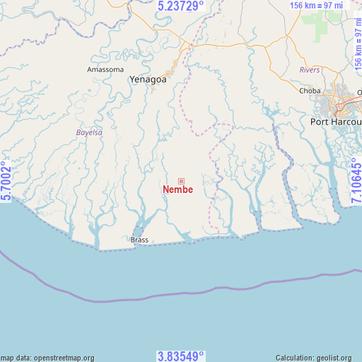
Nembe GPS coordinates[2]
4° 32' 12.228" North, 6° 24' 11.952" East
| Map corner | latitude | longitude |
|---|---|---|
| Upper-left | 5.23729°, | 5.7002° |
| Center: | 4.53673°, | 6.40332° |
| Lower-right: | 3.83549°, | 7.10645° |
| Map W x H: | 155.9×155.9 km | = 96.9×96.9mi |
| max Lat: | 13.7543° ⇑99.6% North |
| Nembe: | 4.53673° |
| min Lat: | ⇓0.4% South 4.31231° |
| min Long | Nembe | max Long |
| 2.73333° | 6.40332° | 14.46552° |
| W 34.1%⇐ | ⇒65.9% E |
Elevation
Elevation of Nembe is 7 m = 23 ft, and this is 289.5 m = 950 ft below average elevation for this country.
| Max E: |
1599 m = 5246 ft | 98.5% |
| Avg. | 296.5 m = 973 ft | |
| Nembe | 7 m = 23 ft | |
Min E: |
2 m = 7 ft | 1.5% |
See also: Nigeria elevation on elevation.city.
Geographical zone
Nembe is located in North Torrid zone (between Equator and Tropic of Cancer). Distance of Equator is 504.4 km =313.4 mi to South.| Distance of | km | miles | from Nembe |
|---|---|---|---|
| North Pole | 9502.6 | 5904.6 | to North |
| Arctic Circle | 6896.7 | 4285.4 | to North |
| Tropic Cancer | 2101.5 | 1305.8 | to North |
| Equator | 504.4 | 313.4 | to South |


Nearby cities:
15 places around Nembe: (largest is in red/bold)
• Abonnema
46.3 km =28.8 mi,  62°
62°
• Abua
44.6 km =27.7 mi,  36°
36°
• Ahoada
66.6 km =41.4 mi,  24°
24°
• Akinima
61.4 km =38.2 mi,  6°
6°
• Amassoma
58.2 km =36.2 mi,  325°
325°
• Buguma
55.5 km =34.5 mi,  66°
66°
• Degema
46.6 km =29 mi, 59°
• Degema Hulk
45.8 km =28.5 mi, 56°
• Emuoha
63.7 km =39.6 mi,  52°
52°
• Kaiama
65.8 km =40.9 mi,  350°
350°
• Obonoma
47.1 km =29.3 mi, 65°
• Ogbia
19.5 km =12.1 mi, 329°
• Oporoma
46.7 km =29 mi,  309°
309°
• Twon-Brass
30.8 km =19.1 mi,  215°
215°
• Yenagoa
45.9 km =28.5 mi,  340°
340°
Sources, notices
• [Note1] Compared only with cities in Nigeria existing in our database
• [Src1] Map data: © OpenStreetMap contributors (CC-BY-SA)
• [Src2] Other city data from geonames.org with taken over terms of usage.
• [Src3] Geographical zone / Annual Mean Temperature by Robert A. Rohde @ Wikipedia
