Igueben geodata
Igueben (Edo) is a seat of a second-order administrative division; located in Nigeria in Africa/Lagos (GMT+1) time zone. In our database, there are 451 cities with bigger population. Compared to other cities in Nigeria, 74.5% of cities are located further ↑North; 67.3% of cities are located further →East and 50.1% of cities have lower elevation than Igueben. Note1


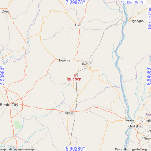
Igueben GPS coordinates[2]
6° 36' 6.588" North, 6° 14' 33.936" East
| Map corner | latitude | longitude |
|---|---|---|
| Upper-left | 7.29978°, | 5.53964° |
| Center: | 6.60183°, | 6.24276° |
| Lower-right: | 5.90289°, | 6.94589° |
| Map W x H: | 155.3×155.3 km | = 96.5×96.5mi |
| max Lat: | 13.7543° ⇑74.5% North |
| Igueben: | 6.60183° |
| min Lat: | ⇓25.5% South 4.31231° |
| min Long | Igueben | max Long |
| 2.73333° | 6.24276° | 14.46552° |
| W 32.7%⇐ | ⇒67.3% E |
Elevation
Elevation of Igueben is 286 m = 938 ft, and this is 10.5 m = 34 ft below average elevation for this country.
| Max E: |
1599 m = 5246 ft | 49.9% |
| Avg. | 296.5 m = 973 ft | |
| Igueben | 286 m = 938 ft | |
Min E: |
2 m = 7 ft | 50.1% |
See also: Nigeria elevation on elevation.city.
Geographical zone
Igueben is located in North Torrid zone (between Equator and Tropic of Cancer). Distance of Equator is 734.1 km =456.1 mi to South.| Distance of | km | miles | from Igueben |
|---|---|---|---|
| North Pole | 9273 | 5762 | to North |
| Arctic Circle | 6667.1 | 4142.7 | to North |
| Tropic Cancer | 1871.9 | 1163.1 | to North |
| Equator | 734.1 | 456.1 | to South |


Nearby cities:
15 places around Igueben: (largest is in red/bold)
• Abudu
41.4 km =25.7 mi,  214°
214°
• Afuze
46.5 km =28.9 mi,  331°
331°
• Agbor
39.1 km =24.3 mi,  187°
187°
• Akwukwu-Igbo
47.1 km =29.3 mi,  125°
125°
• Auchi
51.8 km =32.2 mi,  2°
2°
• Ehor
28.8 km =17.9 mi,  273°
273°
• Ekpoma
19.4 km =12.1 mi,  324°
324°
• Illushi
43.3 km =26.9 mi,  79°
79°
• Irrua
15.2 km =9.4 mi,  350°
350°
• Issele-Uku
40.9 km =25.4 mi,  140°
140°
• Owa-Oyibu
46.9 km =29.1 mi, 185°
• Sabongida-Ora
48 km =29.8 mi,  314°
314°
• Ubiaja
16.8 km =10.4 mi,  69°
69°
• Umunede
38.1 km =23.7 mi,  168°
168°
• Uromi
14.8 km =9.2 mi,  42°
42°
Sources, notices
• [Note1] Compared only with cities in Nigeria existing in our database
• [Src1] Map data: © OpenStreetMap contributors (CC-BY-SA)
• [Src2] Other city data from geonames.org with taken over terms of usage.
• [Src3] Geographical zone / Annual Mean Temperature by Robert A. Rohde @ Wikipedia
