Ijebu-Ife geodata
Ijebu-Ife (Ogun) is a populated place; located in Nigeria in Africa/Lagos (GMT+1) time zone. With population of 5,733 people, there are 449 cities with bigger population in this country. Compared to other cities in Nigeria, 71.6% of cities are located further ↑North; 91.8% of cities are located further →East and 85.4% of cities have higher elevation than Ijebu-Ife. Note1


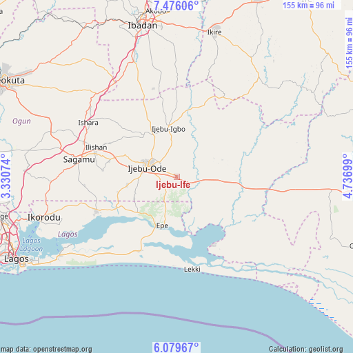
Ijebu-Ife GPS coordinates[2]
6° 46' 42.132" North, 4° 2' 1.896" East
| Map corner | latitude | longitude |
|---|---|---|
| Upper-left | 7.47606°, | 3.33074° |
| Center: | 6.77837°, | 4.03386° |
| Lower-right: | 6.07967°, | 4.73699° |
| Map W x H: | 155.3×155.3 km | = 96.5×96.5mi |
| max Lat: | 13.7543° ⇑71.6% North |
| Ijebu-Ife: | 6.77837° |
| min Lat: | ⇓28.4% South 4.31231° |
| min Long | Ijebu-Ife | max Long |
| 2.73333° | 4.03386° | 14.46552° |
| W 8.2%⇐ | ⇒91.8% E |
Elevation
Elevation of Ijebu-Ife is 55 m = 180 ft, and this is 241.5 m = 792 ft below average elevation for this country.
| Max E: |
1599 m = 5246 ft | 85.4% |
| Avg. | 296.5 m = 973 ft | |
| Ijebu-Ife | 55 m = 180 ft | |
Min E: |
2 m = 7 ft | 14.6% |
See also: Nigeria elevation on elevation.city.
Geographical zone
Ijebu-Ife is located in North Torrid zone (between Equator and Tropic of Cancer). Distance of Equator is 753.7 km =468.3 mi to South.| Distance of | km | miles | from Ijebu-Ife |
|---|---|---|---|
| North Pole | 9253.4 | 5749.8 | to North |
| Arctic Circle | 6647.5 | 4130.6 | to North |
| Tropic Cancer | 1852.2 | 1150.9 | to North |
| Equator | 753.7 | 468.3 | to South |


Nearby cities:
15 places around Ijebu-Ife: (largest is in red/bold)
• Abigi
51.4 km =31.9 mi,  129°
129°
• Akanran
55.9 km =34.7 mi,  359°
359°
• Akodo
39.5 km =24.5 mi,  196°
196°
• Atan
13.3 km =8.3 mi,  347°
347°
• Ejirin
23.5 km =14.6 mi,  218°
218°
• Epe
22.3 km =13.9 mi,  194°
194°
• Idi-Ayunre
54 km =33.6 mi,  339°
339°
• Ijebu-Igbo
21.9 km =13.6 mi, 349°
• Ijebu-Ode
13.7 km =8.5 mi,  289°
289°
• Ikenne
36.5 km =22.7 mi, 285°
• Iperu
43.2 km =26.8 mi, 289°
• Isara
45.7 km =28.4 mi,  301°
301°
• Odogbolu
30.7 km =19.1 mi,  282°
282°
• Ogbere
14.7 km =9.1 mi,  107°
107°
• Shagamu
43.5 km =27 mi, 280°
Sources, notices
• [Note1] Compared only with cities in Nigeria existing in our database
• [Src1] Map data: © OpenStreetMap contributors (CC-BY-SA)
• [Src2] Other city data from geonames.org with taken over terms of usage.
• [Src3] Geographical zone / Annual Mean Temperature by Robert A. Rohde @ Wikipedia
