Ikenne geodata
Ikenne (Ogun) is a seat of a second-order administrative division; located in Nigeria in Africa/Lagos (GMT+1) time zone. In our database, there are 451 cities with bigger population. Compared to other cities in Nigeria, 70.3% of cities are located further ↑North; 94.3% of cities are located further →East and 87.2% of cities have higher elevation than Ikenne. Note1


Ikenne GPS coordinates[2]
6° 51' 56.844" North, 3° 42' 54.648" East
| Map corner | latitude | longitude |
|---|---|---|
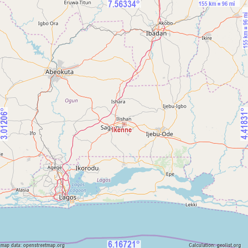
| Upper-left | 7.56334°, | 3.01206° |
| Center: | 6.86579°, | 3.71518° |
| Lower-right: | 6.16721°, | 4.41831° |
| Map W x H: | 155.2×155.2 km | = 96.4×96.4mi |
| max Lat: | 13.7543° ⇑70.3% North |
| Ikenne: | 6.86579° |
| min Lat: | ⇓29.7% South 4.31231° |
| min Long | Ikenne | max Long |
| 2.73333° | 3.71518° | 14.46552° |
| W 5.7%⇐ | ⇒94.3% E |
Elevation
Elevation of Ikenne is 49 m = 161 ft, and this is 247.5 m = 812 ft below average elevation for this country.
| Max E: |
1599 m = 5246 ft | 87.2% |
| Avg. | 296.5 m = 973 ft | |
| Ikenne | 49 m = 161 ft | |
Min E: |
2 m = 7 ft | 12.8% |
See also: Nigeria elevation on elevation.city.
Geographical zone
Ikenne is located in North Torrid zone (between Equator and Tropic of Cancer). Distance of Equator is 763.4 km =474.4 mi to South.| Distance of | km | miles | from Ikenne |
|---|---|---|---|
| North Pole | 9243.7 | 5743.8 | to North |
| Arctic Circle | 6637.8 | 4124.5 | to North |
| Tropic Cancer | 1842.5 | 1144.9 | to North |
| Equator | 763.4 | 474.4 | to South |


Nearby cities:
15 places around Ikenne: (largest is in red/bold)
• Atan
32.4 km =20.1 mi,  84°
84°
• Ebute Ikorodu
38.7 km =24 mi,  220°
220°
• Ejirin
34.6 km =21.5 mi,  143°
143°
• Epe
43.1 km =26.8 mi, 136°
• Idi-Ayunre
43.9 km =27.3 mi,  21°
21°
• Ijebu-Ife
36.5 km =22.7 mi,  105°
105°
• Ijebu-Igbo
33.5 km =20.8 mi,  69°
69°
• Ijebu-Ode
22.9 km =14.2 mi,  103°
103°
• Ikorodu
36.1 km =22.4 mi, 219°
• Iperu
7.4 km =4.6 mi,  311°
311°
• Isara
14.7 km =9.1 mi,  345°
345°
• Odeda
45.7 km =28.4 mi,  333°
333°
• Odogbolu
6 km =3.7 mi,  118°
118°
• Owode
24.9 km =15.5 mi,  291°
291°
• Shagamu
7.8 km =4.8 mi,  255°
255°
Sources, notices
• [Note1] Compared only with cities in Nigeria existing in our database
• [Src1] Map data: © OpenStreetMap contributors (CC-BY-SA)
• [Src2] Other city data from geonames.org with taken over terms of usage.
• [Src3] Geographical zone / Annual Mean Temperature by Robert A. Rohde @ Wikipedia
